MyTopo
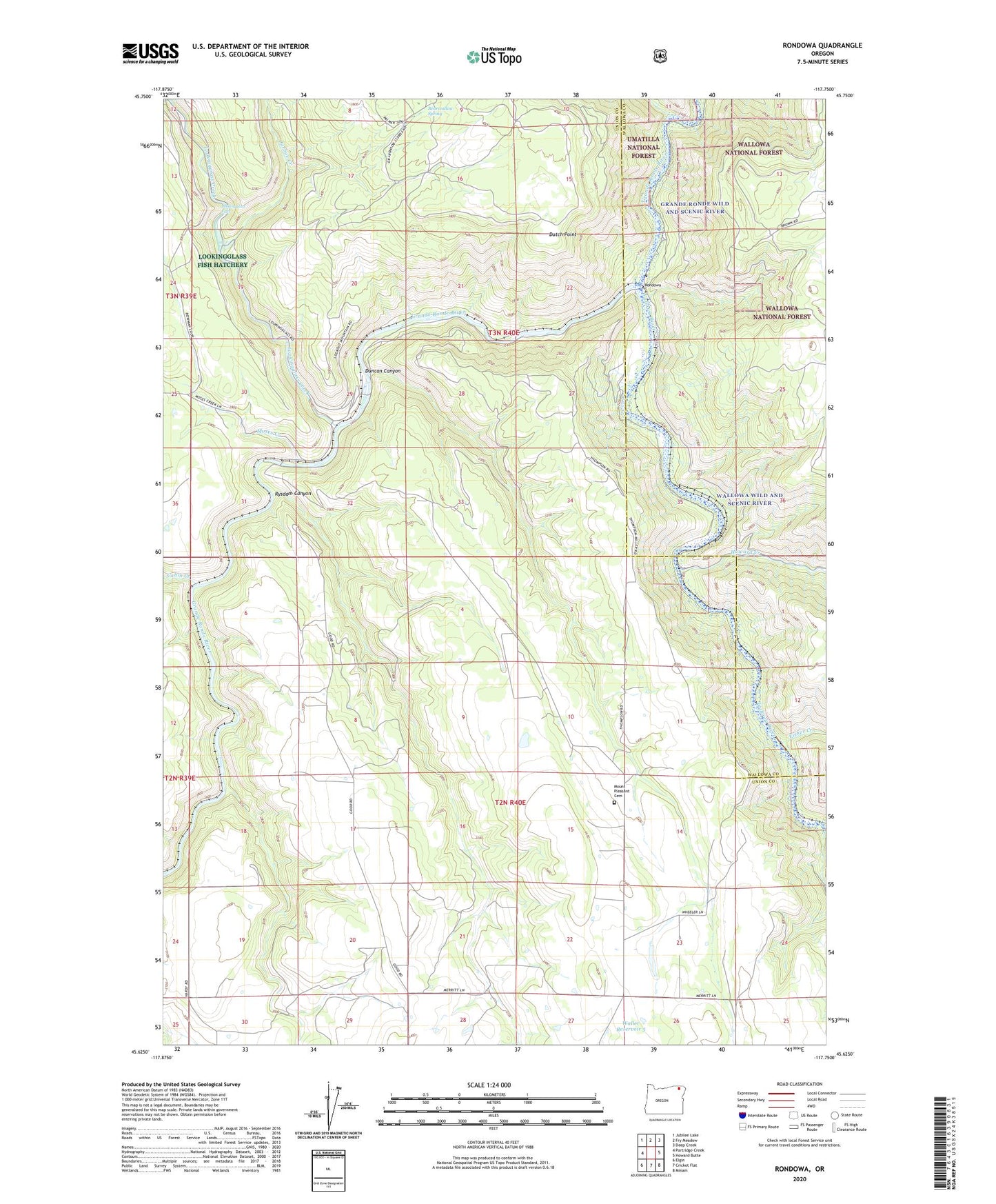
Rondowa Oregon US Topo Map
Couldn't load pickup availability
Also explore the Rondowa Forest Service Topo of this same quad for updated USFS data
2024 topographic map quadrangle Rondowa in the state of Oregon. Scale: 1:24000. Based on the newly updated USGS 7.5' US Topo map series, this map is in the following counties: Union, Wallowa. The map contains contour data, water features, and other items you are used to seeing on USGS maps, but also has updated roads and other features. This is the next generation of topographic maps. Printed on high-quality waterproof paper with UV fade-resistant inks.
Quads adjacent to this one:
West: Partridge Creek
Northwest: Jubilee Lake
North: Fry Meadow
Northeast: Deep Creek
East: Howard Butte
Southeast: Minam
South: Cricket Flat
Southwest: Elgin
This map covers the same area as the classic USGS quad with code o45117f7.
Contains the following named places: Bearwallow Spring, Cabin Creek, Duncan Canyon, Dutch Point, Fisher Creek, Howard Creek, Jarboe Creek, Kimmell, Looking Glass, Lookingglass Creek, Lookingglass Falls, Lookingglass Fish Hatchery, Moses Creek, Mount Pleasant Cemetery, Palmer Junction, Palmer Junction Post Office, Rondowa, Rondowa Post Office, Rysdam Canyon, Scotts Spur, Sheep Creek, Vincent, Waller Reservoir 5, Wallowa River, Wallowa Wild and Scenic River