MyTopo
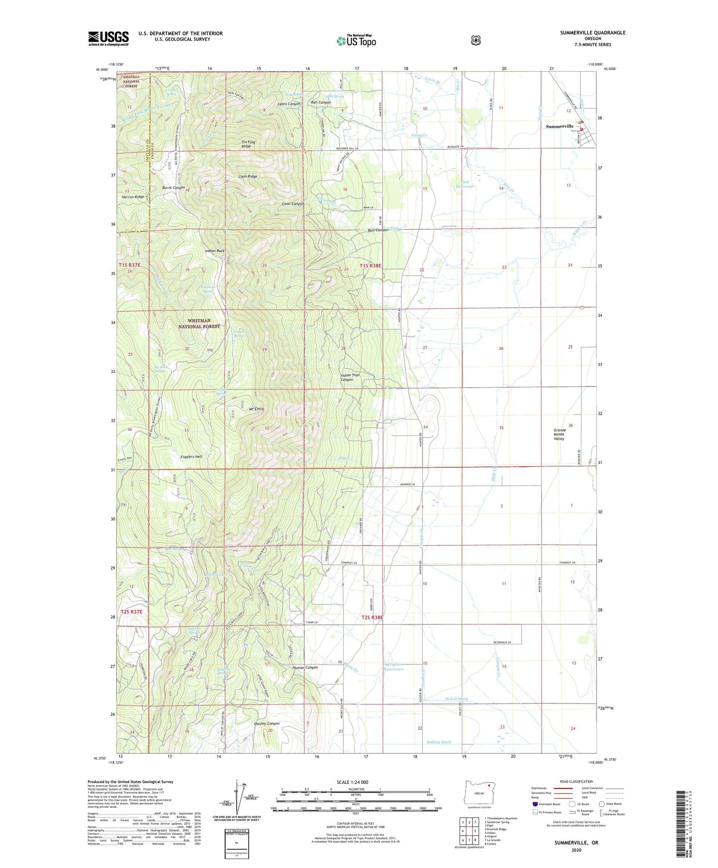
Summerville Oregon US Topo Map
Couldn't load pickup availability
Also explore the Summerville Forest Service Topo of this same quad for updated USFS data
2024 topographic map quadrangle Summerville in the state of Oregon. Scale: 1:24000. Based on the newly updated USGS 7.5' US Topo map series, this map is in the following counties: Union, Umatilla. The map contains contour data, water features, and other items you are used to seeing on USGS maps, but also has updated roads and other features. This is the next generation of topographic maps. Printed on high-quality waterproof paper with UV fade-resistant inks.
Quads adjacent to this one:
West: Drumhill Ridge
Northwest: Thimbleberry Mountain
North: Sanderson Spring
Northeast: Elgin
East: Imbler
Southeast: Conley
South: La Grande
Southwest: Hilgard
This map covers the same area as the classic USGS quad with code o45118d1.
Contains the following named places: Big Rock Spring, Bull Canyon, Canyon Creek, Conklin Spring, Conley Creek, Coon Canyon, Coon Creek, Coon Ridge, Crystal Spring, Dry Creek, End Creek, Evans Trail, Fir Creek, Frizzell Creek, Grandview Campground, Grandview Spring, Grange Hall, Hacker Creek, Hale Spring, Hale Spring Trail, Halfway Spring, Herron Ridge, Hunter Canyon, Imbler Rural Fire Protection District Summerville Station, Indian Rock, Indian Rock Recreation Site, Indian Trail Canyon, Kaleib Spring, Lewis Branch, Lyons Canyon, Mayville Spring, Mint Spring, Mount Emily, Mount Emily Lookout Tower, Mount Emily Sno-Park, Mud Spring, Ordell Ditch, Pioneer Monument, Pole Creek Ridge Trailhead, Rail Canyon, Slide Creek, Smith Creek, South Fork Willow Creek, Starr Reservoir, Summerville, Summerville City Hall, Summerville Post Office, Telephone Spring, Tin Flag Ridge, Town of Summerville, Waite Creek, West Ranch, Wrights Reservoirs, York Reservoir