MyTopo
Colton Oregon US Topo Map
Couldn't load pickup availability
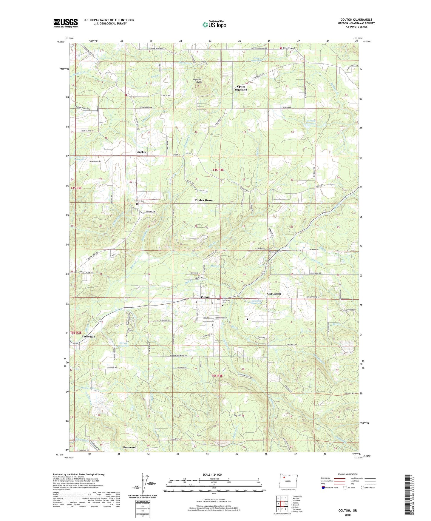
2023 topographic map quadrangle Colton in the state of Oregon. Scale: 1:24000. Based on the newly updated USGS 7.5' US Topo map series, this map is in the following counties: Clackamas. The map contains contour data, water features, and other items you are used to seeing on USGS maps, but also has updated roads and other features. This is the next generation of topographic maps. Printed on high-quality waterproof paper with UV fade-resistant inks.
Quads adjacent to this one:
West: Molalla
Northwest: Oregon City
North: Redland
Northeast: Estacada
East: Elwood
Southeast: Soosap Peak
South: Fernwood
Southwest: Wilhoit
This map covers the same area as the classic USGS quad with code o45122b4.
Contains the following named places: Alder Creek, Aspen Meadow Church, Beaver Dam, Bee Creek, Big Hill, Bittner Creek, Bonney Cemetery, Bull Creek, Camp Adams, Camp Colton, Canyon Creek, Cedar Creek Reservoir, Cedar Reservoir, Cedardale, Christ Light Community Church, Clackamas Fire District Number 1 Station 13 Clarkes, Clackamas Fire District Number 1 Station 20 Highland, Clarkes, Clarkes Elementary School, Clarkes Pioneer Cemetery, Clarkes Post Office, Colton, Colton Community Church, Colton Division, Colton Elementary School, Colton Evangelical Lutheran Church, Colton High School, Colton Lutheran Cemetery, Colton Middle School, Colton Post Office, Colton Rural Fire Protection District 70 Main Station, Dorn Creek, Hancock Creek, Highland, Highland Butte, Highland Post Office, Horning Reservoir, Jackson Creek, James Post Office, Karney Reservoir, May Creek, Mill Creek, Nate Creek, Old Colton, Randall Creek, Ringo Point Post Office, Rock Creek, South Fork Bee Creek, Swanson Reservoir, Timber Grove, Unbroken Fellowship Church, Upper Highland, ZIP Code: 97017