MyTopo
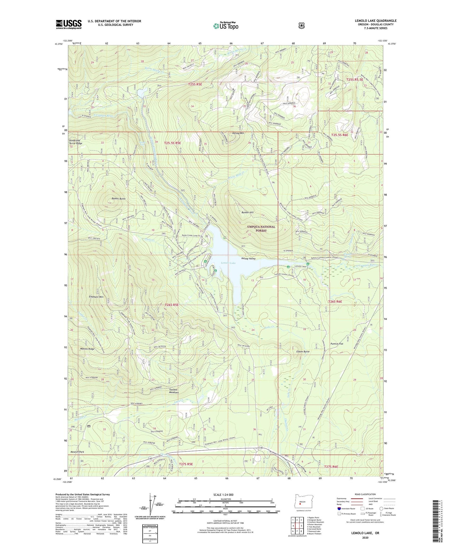
Lemolo Lake Oregon US Topo Map
Couldn't load pickup availability
Also explore the Lemolo Lake Forest Service Topo of this same quad for updated USFS data
2024 topographic map quadrangle Lemolo Lake in the state of Oregon. Scale: 1:24000. Based on the newly updated USGS 7.5' US Topo map series, this map is in the following counties: Douglas. The map contains contour data, water features, and other items you are used to seeing on USGS maps, but also has updated roads and other features. This is the next generation of topographic maps. Printed on high-quality waterproof paper with UV fade-resistant inks.
Quads adjacent to this one:
West: Potter Mountain
Northwest: Rigdon Point
North: Emigrant Butte
Northeast: Cowhorn Mountain
East: Tolo Mountain
Southeast: Mount Thielsen
South: Diamond Lake
Southwest: Garwood Butte
This map covers the same area as the classic USGS quad with code o43122c2.
Contains the following named places: Basket Butte, Bunker Hill, Bunker Hill Recreation Site, Crystal Creek, Crystal Springs, East Lemolo Recreation Site, Elbow Butte, Elephant Mountain, Inlet Recreation Site, Kelsay Mountain, Kelsay Valley, Lake Creek, Lake Creek Forest Camp, Lemolo Canal Number 1, Lemolo Falls, Lemolo Lake, Lemolo Lake Boat Ramp North, Lemolo Lake Boat Ramp South, Lemolo Lake Resort, Lemolo Number 1 Dam, Lemolo Number 2 Forebay Dam, Poole Creek, Poole Creek Recreation Site, Pumice Flat, Spring River, Thielsen Creek, Thielsen Forest Camp, Thirsty Creek, Toolbox Meadows, Warm Spring Creek, Watson Ridge, White Mule Creek, Windigo Way