MyTopo
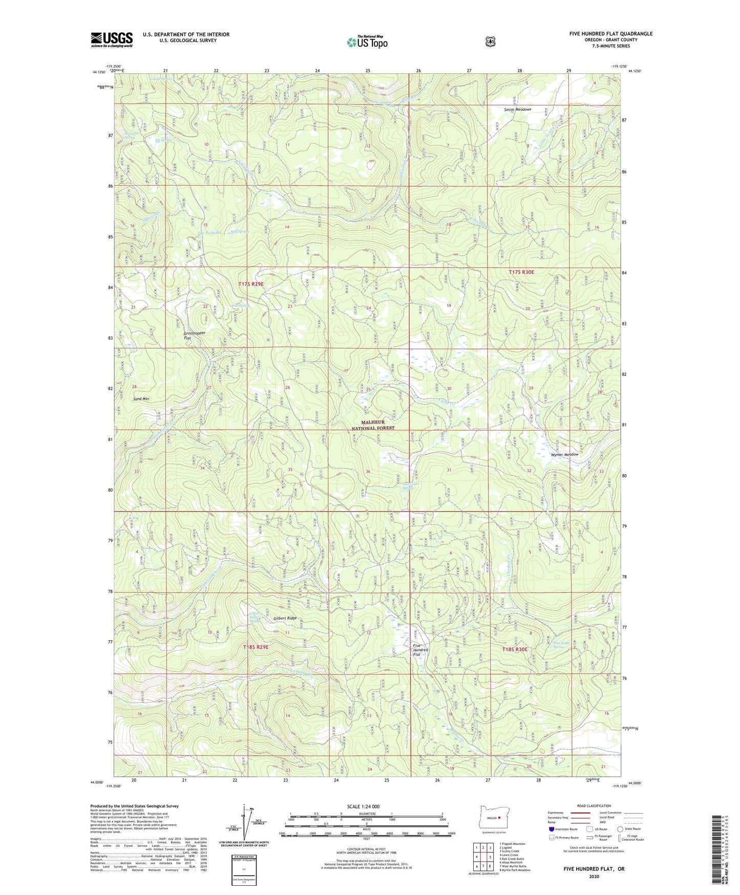
Five Hundred Flat Oregon US Topo Map
Couldn't load pickup availability
Also explore the Five Hundred Flat Forest Service Topo of this same quad for updated USFS data
2023 topographic map quadrangle Five Hundred Flat in the state of Oregon. Scale: 1:24000. Based on the newly updated USGS 7.5' US Topo map series, this map is in the following counties: Grant. The map contains contour data, water features, and other items you are used to seeing on USGS maps, but also has updated roads and other features. This is the next generation of topographic maps. Printed on high-quality waterproof paper with UV fade-resistant inks.
Quads adjacent to this one:
West: Lewis Creek
Northwest: Flagtail Mountain
North: Logdell
Northeast: Scotty Creek
East: Rail Creek Butte
Southeast: Myrtle Park Meadows
South: West Myrtle Butte
Southwest: Alsup Mountain
This map covers the same area as the classic USGS quad with code o44119a2.
Contains the following named places: Cheatem Holler Camp, East Scotty Creek, Elk Spring, Elkhorn Cow Camp, Five Hundred Flat, Gilbert Ridge, Gilbert Ridge Spring, Grasshopper Flat, Last Cabin Spring, Lemcke Spring, Lost Cabin, McArthur Spring, Mud Spring, North Scotty Creek, Pine Ridge Spring, Pine Spring, Sand Mountain, Smith Meadows, South Scotty Creek, The Potholes, Wymer Meadow