MyTopo
Fourth of July Creek Oregon US Topo Map
Couldn't load pickup availability
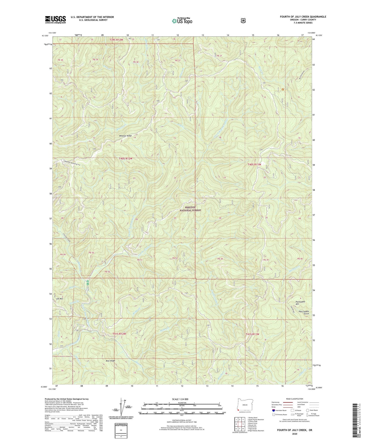
2020 topographic map quadrangle Fourth of July Creek in the state of Oregon. Scale: 1:24000. Based on the newly updated USGS 7.5' US Topo map series, this map is in the following counties: Curry. The map contains contour data, water features, and other items you are used to seeing on USGS maps, but also has updated roads and other features. This is the next generation of topographic maps. Printed on high-quality waterproof paper with UV fade-resistant inks.
Quads adjacent to this one:
West: Mount Emily
Northwest: Bosley Butte
North: Quail Prairie Mountain
Northeast: Chetco Peak
East: Biscuit Hill
Southeast: High Plateau Mountain
South: High Divide
Southwest: Smith River
Contains the following named places: Bear Creek, Bear Ridge, Bear Wallow Lookout, Bridge Creek, Dry Creek, East Fork Winchuck River, Elk Creek, Elk Mountain, Emily Creek Way, First Camp Recreation Site, Fourth of July Creek, Harbor Division, Kink Creek, Louise Creek, Ludlum House Recreation Site, Ludlum Place, Packsaddle Lookout, Packsaddle Mountain, Packsaddle Trail, Salmon Creek, Sankey Creek, Wheeler Creek, Wheeler Creek Natural Research Area, Wheeler Ridge, Winchuck Recreation Site