
MyTopo
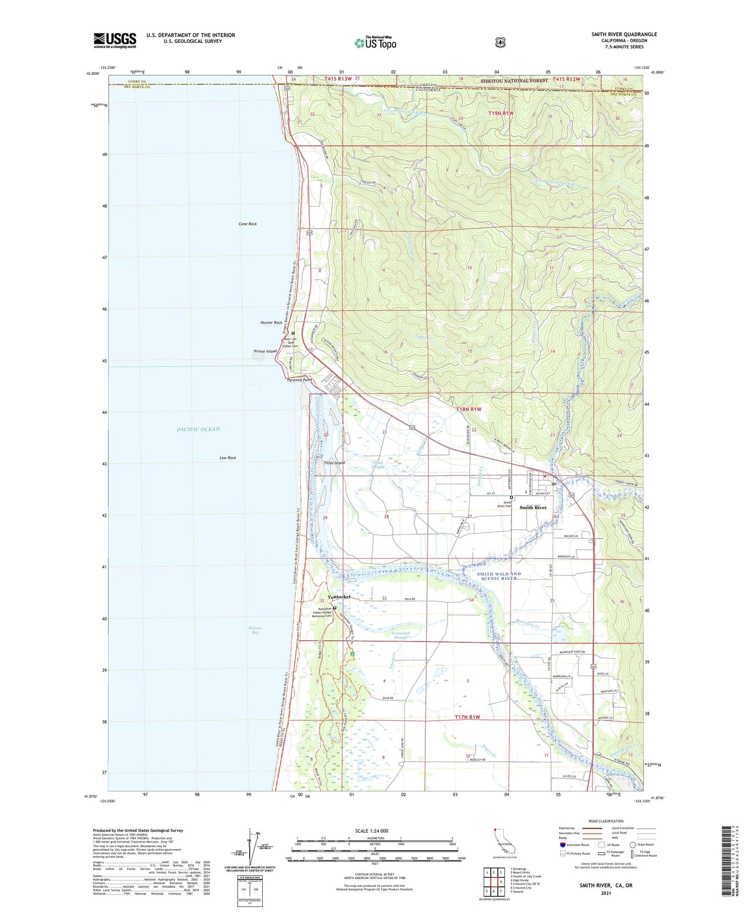
Smith River California US Topo Map
Couldn't load pickup availability
Also explore the Smith River Forest Service Topo of this same quad for updated USFS data
2021 topographic map quadrangle Smith River in the states of California, Oregon. Scale: 1:24000. Based on the newly updated USGS 7.5' US Topo map series, this map is in the following counties: Del Norte, Curry. The map contains contour data, water features, and other items you are used to seeing on USGS maps, but also has updated roads and other features. This is the next generation of topographic maps. Printed on high-quality waterproof paper with UV fade-resistant inks.
Quads adjacent to this one:
Northwest: Brookings
North: Mount Emily
Northeast: Fourth of July Creek
East: High Divide
Southeast: Hiouchi
South: Crescent City
Southwest: Crescent City OE W
Contains the following named places: Cone Rock, Crissey Airport, Delilah Creek, Dominie Creek, Faith Tabernacle Assembly of God Church, Gilbert Creek, How - On - Quet Indian Cemetery, Hunter Rock, Hutsinpillar Creek, Indian Cemetery, Kamph Memorial Park, Khoonkhwuttunne, Lopez Creek, Low Rock, Morrison Creek, Pelican State Beach, Prince Island, Pyramid Point, Ritmer Creek, Rowdy Creek, Rowdy Creek School, Ship Ashore Landing Strip, Ship Ashore Race Track, Smith River, Smith River Baptist Church, Smith River Cemetery, Smith River Census Designated Place, Smith River Elementary School, Smith River Fire Protection District, Smith River Post Office, Smith River Public Fishing Access, Smith River Rancheria, Smith River United Methodist Church, South Fork Winchuck River, Tillas Island, Tillas Slough, Tryon Corner, Tryon Creek, Yontocket, Yontocket Indian Village Memorial Cemetery, Yontocket Slough


