MyTopo
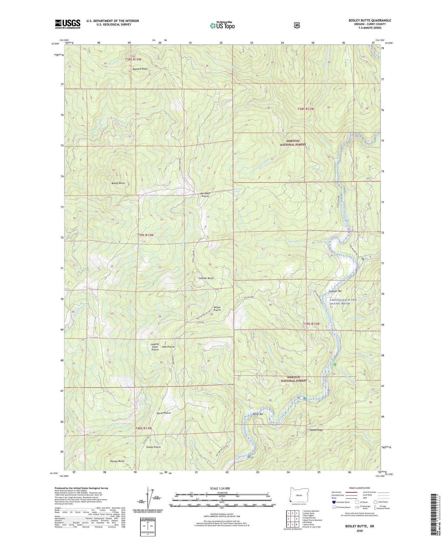
Bosley Butte Oregon US Topo Map
Couldn't load pickup availability
Also explore the Bosley Butte Forest Service Topo of this same quad for updated USFS data
2024 topographic map quadrangle Bosley Butte in the state of Oregon. Scale: 1:24000. Based on the newly updated USGS 7.5' US Topo map series, this map is in the following counties: Curry. The map contains contour data, water features, and other items you are used to seeing on USGS maps, but also has updated roads and other features. This is the next generation of topographic maps. Printed on high-quality waterproof paper with UV fade-resistant inks.
Quads adjacent to this one:
West: Carpenterville
Northwest: Sundown Mountain
North: Collier Butte
Northeast: Big Craggies
East: Quail Prairie Mountain
Southeast: Fourth of July Creek
South: Mount Emily
Southwest: Brookings
This map covers the same area as the classic USGS quad with code o42124b2.
Contains the following named places: Big Redwood Creek, Bosley Butte, Bravo Ranch, Buzzard Roost, Cashner Butte, Eagle Creek, First Creek, Gardner Bar, Horse Prairie, Ice Box Hole Boat Launch, Little Redwood Creek, Little Redwood Recreation Site, Looking-Glass Prairie, Miller Bar, Miller Bar Boat Launch, Miller Bar Recreation Site, Mineral Hill Fork, Nook Bar Boat Launch, Nook Bar Recreation Site, Nook Creek, Northern Prairie, Palmer Butte, Panther Creek, Prairie Creek, Rainbow Creek, Ransom Creek, Redwood Bar Boat Launch, Redwood Bar Recreation Site, Robinson Spring, Robinson Spring Creek, Second Creek, South Fork Boat Launch, South Fork Camp Recreation Site, South Fork Chetco River, Stump Prairie, Wilson Creek, Wilson Prairie, Yank Prairie