MyTopo
Gaston Oregon US Topo Map
Couldn't load pickup availability
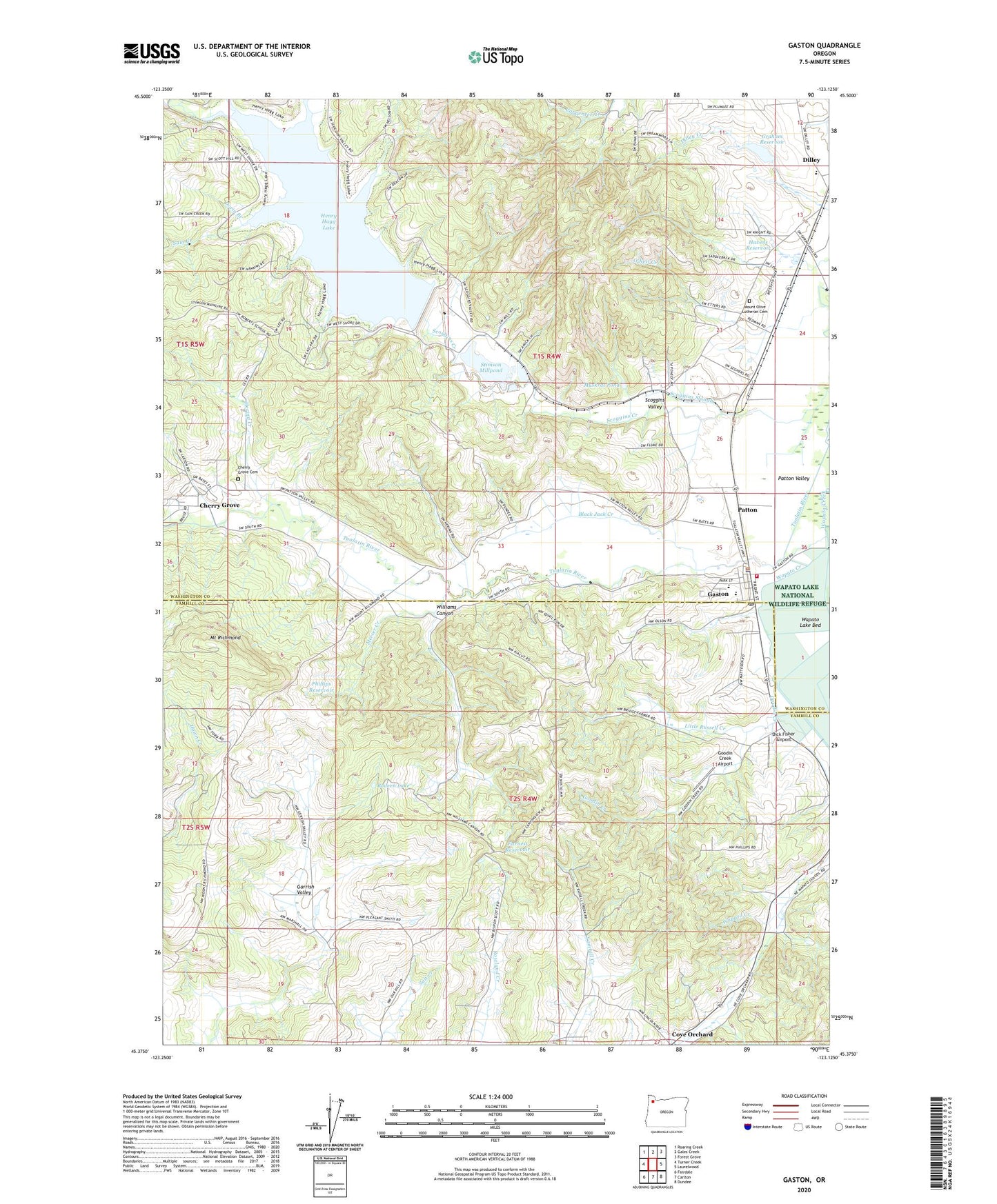
2024 topographic map quadrangle Gaston in the state of Oregon. Scale: 1:24000. Based on the newly updated USGS 7.5' US Topo map series, this map is in the following counties: Washington, Yamhill. The map contains contour data, water features, and other items you are used to seeing on USGS maps, but also has updated roads and other features. This is the next generation of topographic maps. Printed on high-quality waterproof paper with UV fade-resistant inks.
Quads adjacent to this one:
West: Turner Creek
Northwest: Roaring Creek
North: Gales Creek
Northeast: Forest Grove
East: Laurelwood
Southeast: Dundee
South: Carlton
Southwest: Fairdale
This map covers the same area as the classic USGS quad with code o45123d2.
Contains the following named places: Black Jack Creek, Bodeen Dam, Bodeen Lake, Cherry Grove, Cherry Grove Cemetery, Cherry Grove Census Designated Place, Cherry Grove Post Office, City of Gaston, Cove Orchard, Cove Orchard Post Office, Dellwood, Dick Fisher Airport, Dilley Elementary School, Dorin Branch, Earnest Reservoir, Elk Cove Vineyards, Forest Dale School, Garrish Valley, Gaston, Gaston City Hall, Gaston Elementary School, Gaston Junior and Senior High School, Gaston Municipal Court, Gaston Police Department, Gaston Post Office, Gaston Rural Fire Protection District, Goodin Creek, Goodin Creek Airport, Graham Dam, Graham Reservoir, Grand Cru Estates, Havens Reservoir, Hawks Mountain Ranch, Henry Hagg County Park, Henry Hagg Lake, Henry Hagg Lake County Park Ramp A, Henry Hagg Lake County Park Ramp C, Hering Creek, Hill Creek, Kramer Vineyards, Library of Gaston, Little Russell Creek, Mercer Creek, Mount Olive Lutheran Cemetery, Mount Richmond, Mulholland Farms, Muskrat Pond, O'Neil Creek, Patton, Patton Valley, Phillips Reservoir, Roberts School, Sain Creek, Scoggins Creek, Scoggins Creek Picnic Area, Scoggins Dam, Scoggins Slough, Scoggins Valley, Seghers, Seghers Post Office, Seth School, Stimson Lumber Company Wastewater Treatment Facility, Stimson Mill, Stimson Millpond, Teffer, Upstream Ranch, Valley Baptist Church, Wapato Lake National Wildlife Refuge, Wapato Valley Church, Wapatoo Post Office, Western Division Service Center Airport, Williams Canyon, ZIP Code: 97119