MyTopo
Gwendolen Oregon US Topo Map
Couldn't load pickup availability
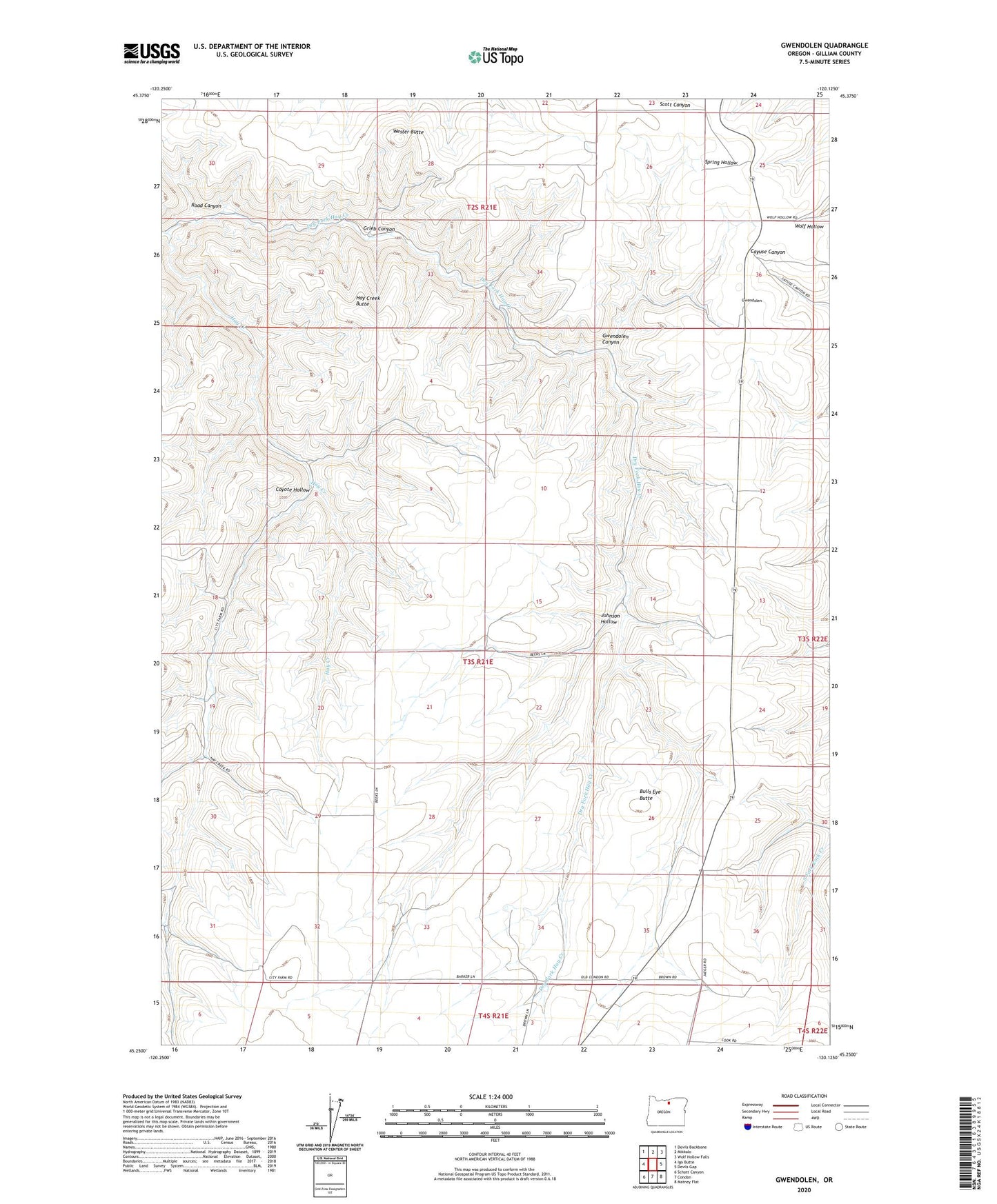
2024 topographic map quadrangle Gwendolen in the state of Oregon. Scale: 1:24000. Based on the newly updated USGS 7.5' US Topo map series, this map is in the following counties: Gilliam. The map contains contour data, water features, and other items you are used to seeing on USGS maps, but also has updated roads and other features. This is the next generation of topographic maps. Printed on high-quality waterproof paper with UV fade-resistant inks.
Quads adjacent to this one:
West: Igo Butte
Northwest: Devils Backbone
North: Mikkalo
Northeast: Wolf Hollow Falls
East: Devils Gap
Southeast: Matney Flat
South: Condon
Southwest: Schott Canyon
This map covers the same area as the classic USGS quad with code o45120c2.
Contains the following named places: Bulls Eye Butte, City Farm, Condon Water Supply Pump, Coyote Hollow, Dry Fork Hay Creek, Grieb Canyon, Gwendolen, Gwendolen Canyon, Gwendolen Post Office, Gwendolen School, Hay Creek Butte, Johnson Airstrip, Johnson Hollow, Road Canyon, Wester Butte