MyTopo
Halfway Oregon US Topo Map
Couldn't load pickup availability
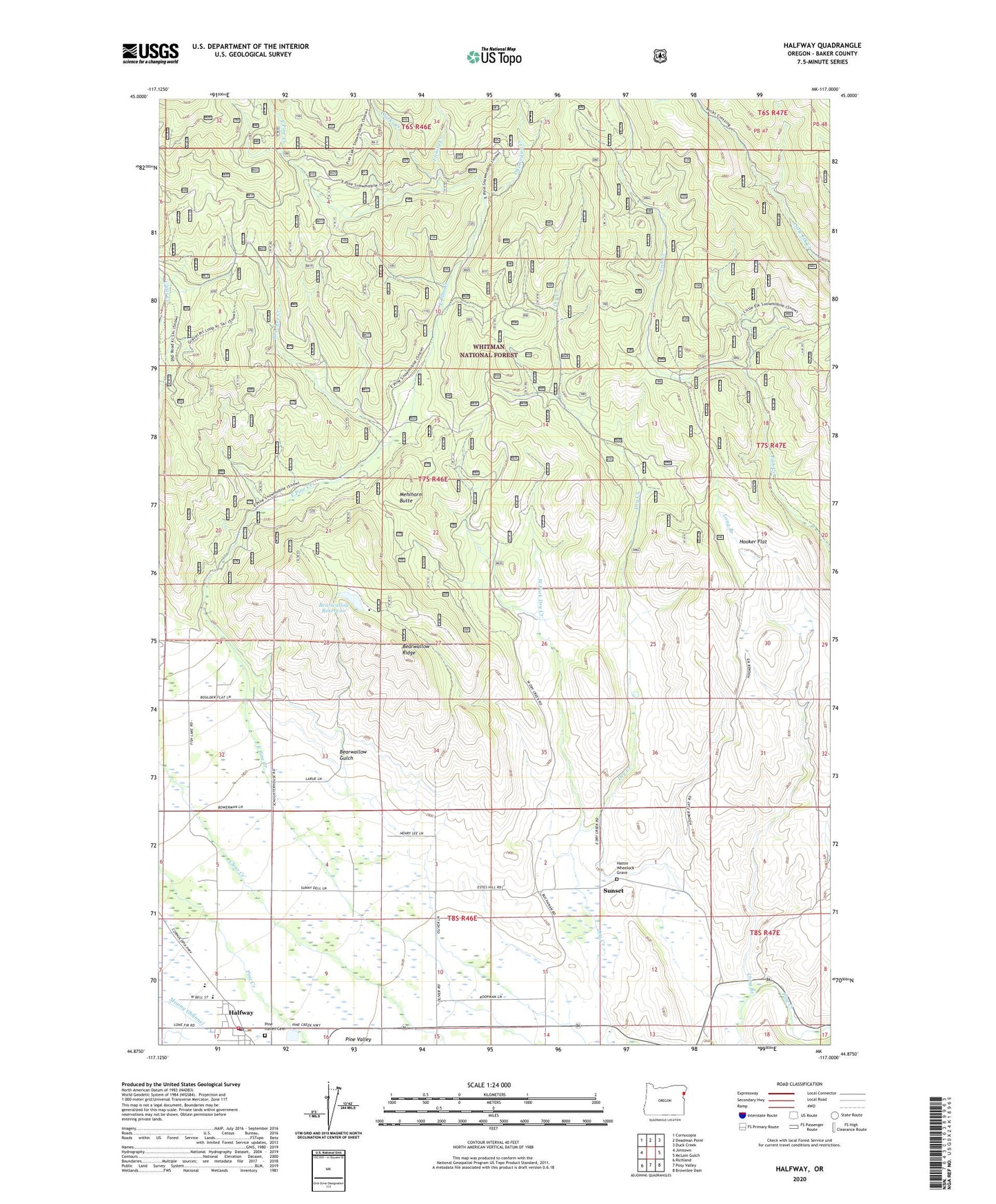
2020 topographic map quadrangle Halfway in the state of Oregon. Scale: 1:24000. Based on the newly updated USGS 7.5' US Topo map series, this map is in the following counties: Baker. The map contains contour data, water features, and other items you are used to seeing on USGS maps, but also has updated roads and other features. This is the next generation of topographic maps. Printed on high-quality waterproof paper with UV fade-resistant inks.
Quads adjacent to this one:
West: Jimtown
Northwest: Cornucopia
North: Deadman Point
Northeast: Duck Creek
East: McLain Gulch
Southeast: Brownlee Dam
South: Posy Valley
Southwest: Richland
Contains the following named places: Baker County Fairgrounds and Rodeo Grounds, Baker County Library Halfway Branch Library, Bearwallow Gulch, Bearwallow Reservoir, Bearwallow Ridge, Beecher Creek, City of Halfway, Clarks Creek, Halfway, Halfway City Hall, Halfway Division, Halfway Elementary School, Halfway Oxbow Ambulance Service, Halfway Post Office, Halfway Public Works Department Office, Halfway Sewage Treatment Lagoons, Hattie Wheelock Grave, Heritage Square, Hooker Flat, Long Branch, Mehlhorn Butte, Mehlhorn Mill, Okanogan Creek, Oliver Homestead, Pine Eagle Elementary, Pine Eagle High School, Pine Haven Cemetery, Pine Valley Community Museum, Pine Valley Rural Fire Protection District, R K Moseley Dam, Sunset, Sunset Post Office, Trinity Creek, Union High School, West Fork Dry Creek