MyTopo
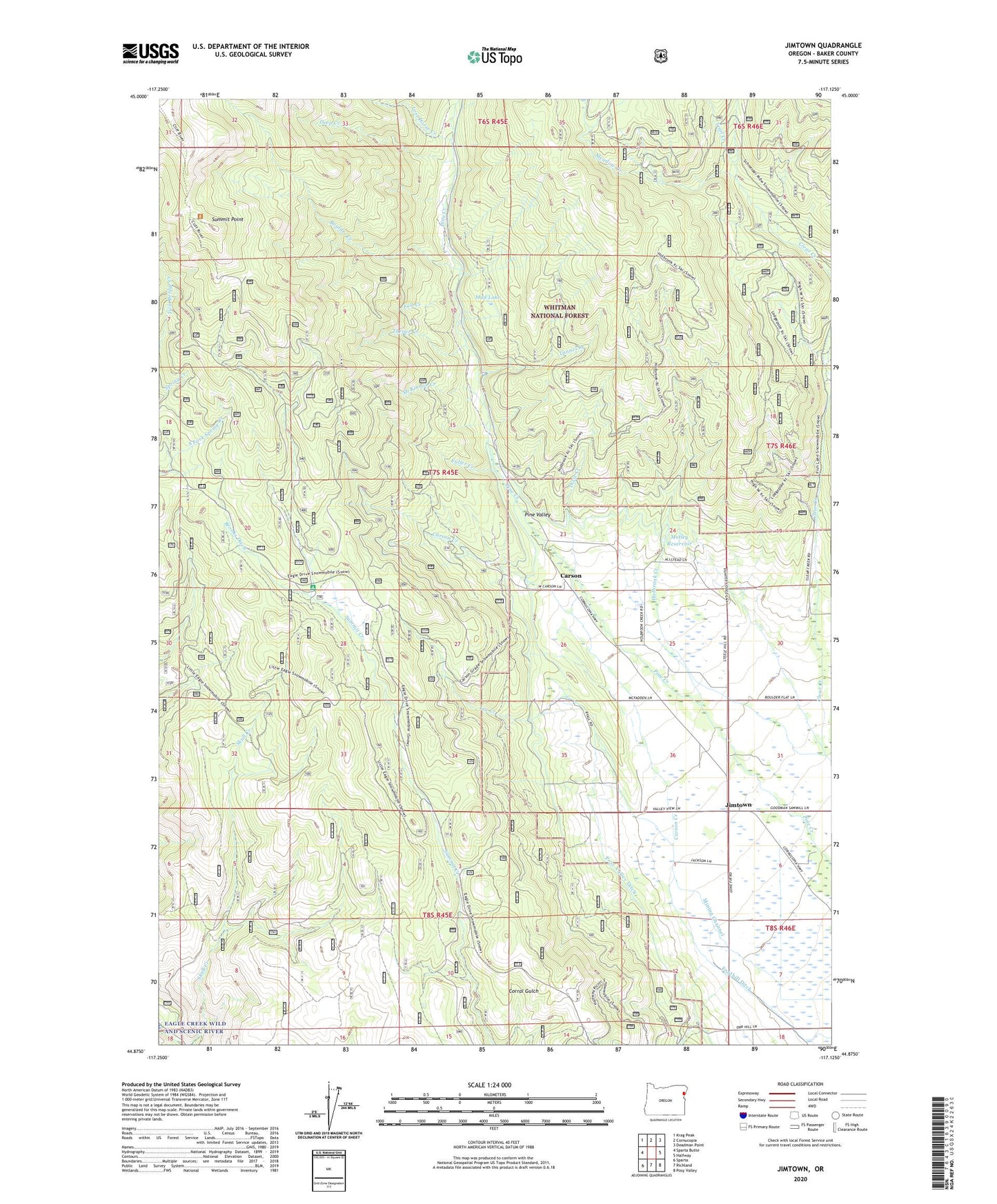
Jimtown Oregon US Topo Map
Couldn't load pickup availability
Also explore the Jimtown Forest Service Topo of this same quad for updated USFS data
2023 topographic map quadrangle Jimtown in the state of Oregon. Scale: 1:24000. Based on the newly updated USGS 7.5' US Topo map series, this map is in the following counties: Baker. The map contains contour data, water features, and other items you are used to seeing on USGS maps, but also has updated roads and other features. This is the next generation of topographic maps. Printed on high-quality waterproof paper with UV fade-resistant inks.
Quads adjacent to this one:
West: Sparta Butte
Northwest: Krag Peak
North: Cornucopia
Northeast: Deadman Point
East: Halfway
Southeast: Posy Valley
South: Richland
Southwest: Sparta
This map covers the same area as the classic USGS quad with code o44117h2.
Contains the following named places: Boulder Creek, Brooks Ditch, Carson, Carson Creek, Carson Post Office, Deep Creek, Dixie Creek, Fall Creek, Foothill Ditch, Fuller Creek, Halfway Recreation Site, Holbrook Creek, Jimtown, Lost Horse Creek, McBride Guard Station, McBride Recreation Site, McKinnon Creek, Meadow Creek, Mining Channel, Motley Reservoir, Mud Lake, Summit Point, Summit Point Trailhead, Trail Creek, Tunnel Creek, Turner Creek, ZIP Code: 97834