MyTopo
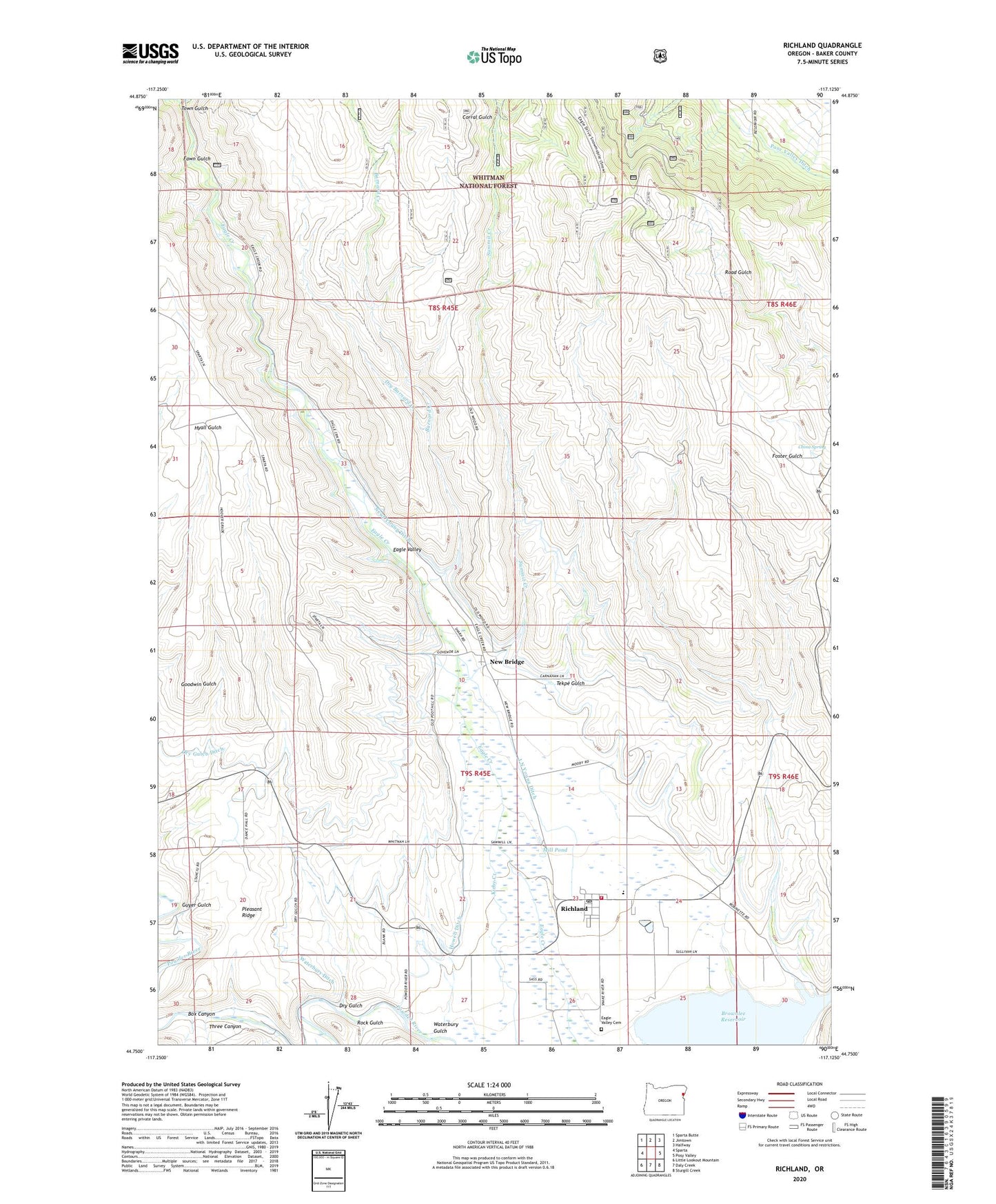
Richland Oregon US Topo Map
Couldn't load pickup availability
Also explore the Richland Forest Service Topo of this same quad for updated USFS data
2024 topographic map quadrangle Richland in the state of Oregon. Scale: 1:24000. Based on the newly updated USGS 7.5' US Topo map series, this map is in the following counties: Baker. The map contains contour data, water features, and other items you are used to seeing on USGS maps, but also has updated roads and other features. This is the next generation of topographic maps. Printed on high-quality waterproof paper with UV fade-resistant inks.
Quads adjacent to this one:
West: Sparta
Northwest: Sparta Butte
North: Jimtown
Northeast: Halfway
East: Posy Valley
Southeast: Sturgill Creek
South: Daly Creek
Southwest: Little Lookout Mountain
This map covers the same area as the classic USGS quad with code o44117g2.
Contains the following named places: Baker County Library Richland Branch Library, Barnard Creek, China Spring, City of Richland, Coin Creek, Corral Gulch, Cundiff Slough, Deer Gulch, Dry Barnard Creek, Dry Gulch, Dry Gulch Ditch, Eagle Valley Cemetery, Eagle Valley Rural Fire Protection District, Fawn Gulch, Guyer Gulch, Harry M Hewitt Memorial Park, Hewitt / Holcomb Parks Boat Ramp, Hewitt / Holcomb Parks Boat Ramp 2, Howell Ditch, I N Young Ditch, Immigrant Gulch, Mill Pond, New Bridge, New Bridge Post Office, Newt Young Ditch, Pleasant Ridge, Posy Valley Ditch, Richland, Richland City Hall, Richland Elementary School, Richland Post Office, Richland Public Works Department Office, Richland Wastewater Treatment Ponds, Road Gulch, Rock Gulch, Skull Creek, Spring Creek Ditch, Summit Creek, Tekpe Gulch, Three Canyon, Tobin Ditch, Town Gulch, Waterbury Ditch, Waterbury Gulch, ZIP Code: 97870