MyTopo
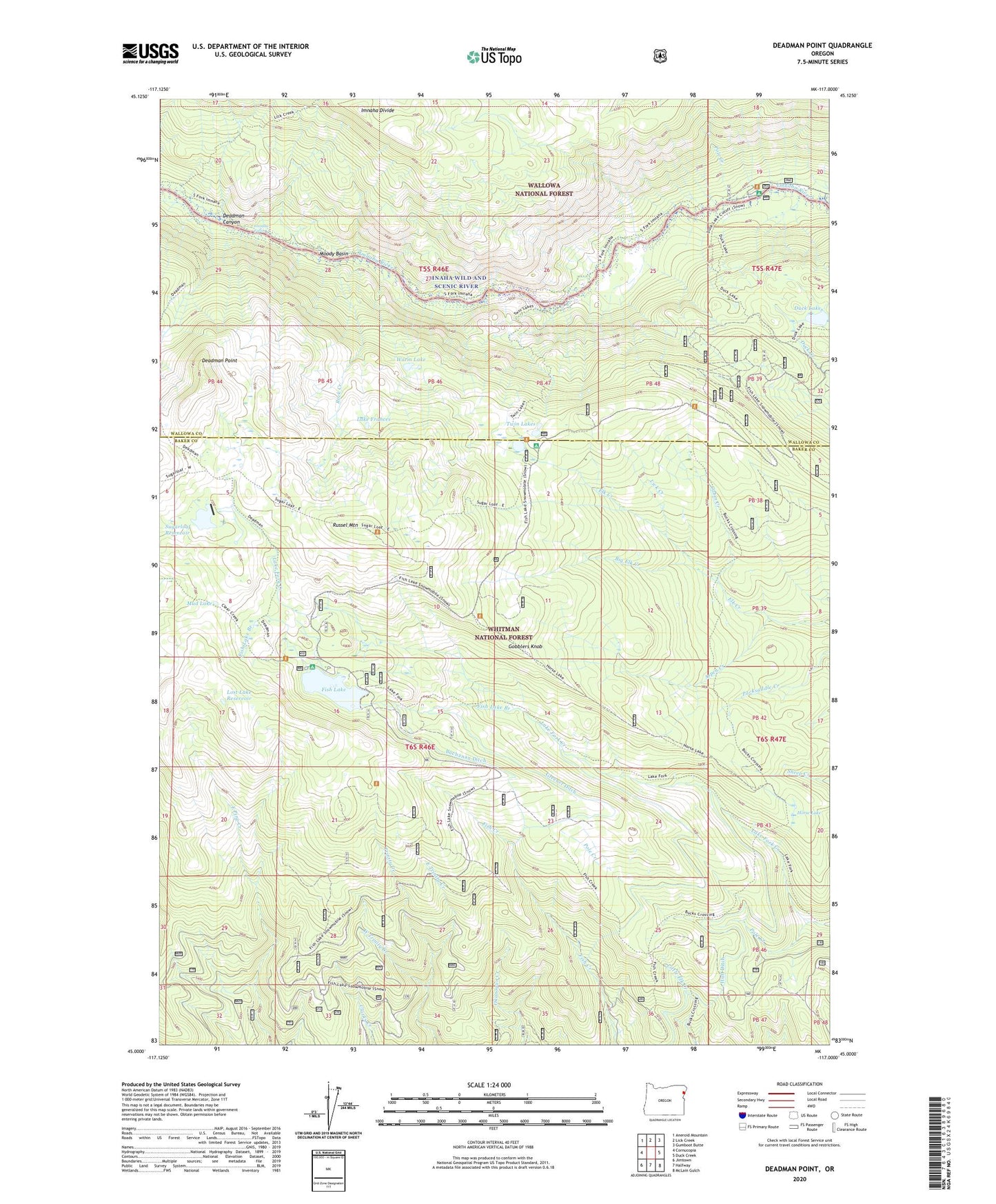
Deadman Point Oregon US Topo Map
Couldn't load pickup availability
Also explore the Deadman Point Forest Service Topo of this same quad for updated USFS data
2023 topographic map quadrangle Deadman Point in the state of Oregon. Scale: 1:24000. Based on the newly updated USGS 7.5' US Topo map series, this map is in the following counties: Baker, Wallowa. The map contains contour data, water features, and other items you are used to seeing on USGS maps, but also has updated roads and other features. This is the next generation of topographic maps. Printed on high-quality waterproof paper with UV fade-resistant inks.
Quads adjacent to this one:
West: Cornucopia
Northwest: Aneroid Mountain
North: Lick Creek
Northeast: Gumboot Butte
East: Duck Creek
Southeast: McLain Gulch
South: Halfway
Southwest: Jimtown
This map covers the same area as the classic USGS quad with code o45117a1.
Contains the following named places: Aspen Creek, Big Elk Creek, Buchanan Ditch, Cabin Creek, Deadman Canyon, Deadman Point, Duck Lake, East Trinity Creek, Fish Lake, Fish Lake Branch, Fish Lake Campground Boat Launch, Fish Lake Dam, Fish Lake Guard Station, Fish Lake Recreation Site, Gobblers Knob, Greener Ditch, Horse Lake, Huff Ditch, Imnaha Falls, Indian Crossing, Indian Crossing Recreation Site, Lake Frances, Lick Creek, Lost Lake Reservoir, Moody Basin, Mud Lake, Pole Creek, Rock Creek, Russel Mountain, Sugarloaf Dam, Sugarloaf Reservoir, Trinity Guard Station, Twin Lakes, Twin Lakes Recreation Site, Warm Lake, West Trinity Creek