MyTopo
Hamlet Oregon US Topo Map
Couldn't load pickup availability
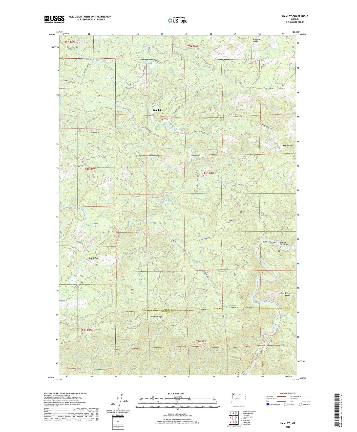
2020 topographic map quadrangle Hamlet in the state of Oregon. Scale: 1:24000. Based on the newly updated USGS 7.5' US Topo map series, this map is in the following counties: Clatsop, Tillamook. The map contains contour data, water features, and other items you are used to seeing on USGS maps, but also has updated roads and other features. This is the next generation of topographic maps. Printed on high-quality waterproof paper with UV fade-resistant inks.
Quads adjacent to this one:
West: Soapstone Lake
Northwest: Necanicum Junction
North: Saddle Mountain
Northeast: Vinemaple
East: Elsie
Southeast: Rogers Peak
South: Cook Creek
Southwest: Foley Peak
Contains the following named places: Beaver Eddy, Cole Mountain, Cougar Mountain, Cronin Creek, Fall Creek, Gods Valley, Gods Valley Creek, Hamlet, Hamlet Grange, Hamlet Post Office, Little North Fork Nehalem River, Lost Creek, Morrison Eddy, North Fork Falls, Owens Post Office, Rector Creek, Rector Lookout, Rector Ridge, Salmonberry Guard Station, Sweet Home Creek, Yunkers High Bridge