
MyTopo
Harness Mountain Oregon US Topo Map
Couldn't load pickup availability
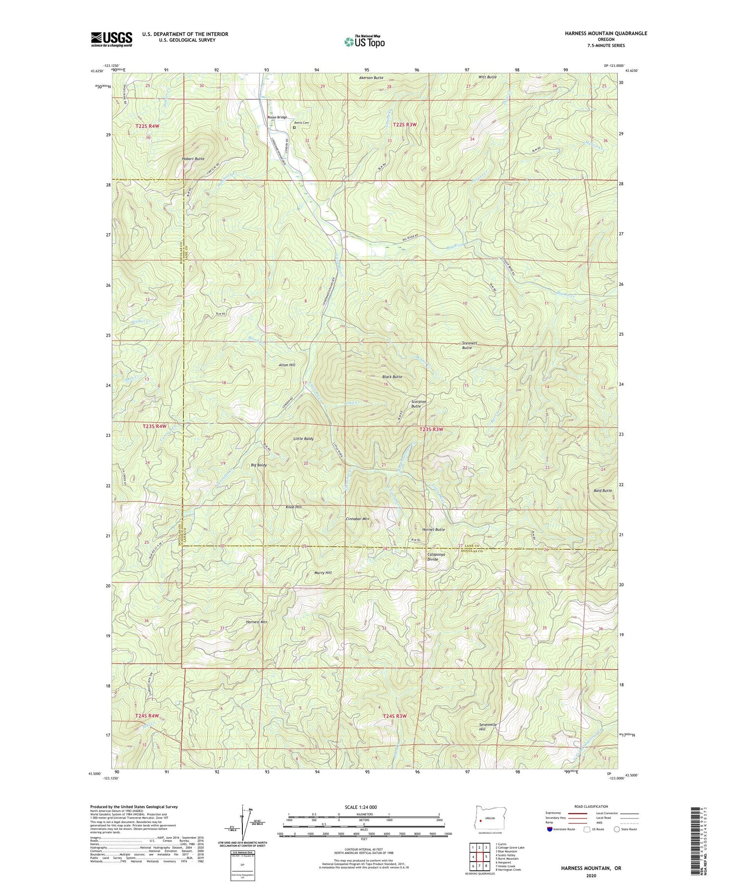
2020 topographic map quadrangle Harness Mountain in the state of Oregon. Scale: 1:24000. Based on the newly updated USGS 7.5' US Topo map series, this map is in the following counties: Lane, Douglas. The map contains contour data, water features, and other items you are used to seeing on USGS maps, but also has updated roads and other features. This is the next generation of topographic maps. Printed on high-quality waterproof paper with UV fade-resistant inks.
Quads adjacent to this one:
West: Scotts Valley
Northwest: Curtin
North: Cottage Grove Lake
Northeast: Blue Mountain
East: Burnt Mountain
Southeast: Harrington Creek
South: Hinkle Creek
Southwest: Nonpareil
Contains the following named places: Akerson Butte, Alton Hill, Amos, Amos Post Office, Bald Butte, Bar Creek, Bemis Cemetery, Big Baldy, Big River, Black Butte, Black Butte Mine, Blackbutte Post Office, Blood Creek, Carlson Creek, Cinnabar Creek, Cinnabar Mountain, Combs Creek, Deer Creek, Dennis Creek, Drue Creek, East Cinnabar Creek, Garoutte Creek, Hambrick Creek, Harness Mountain, Hobart Butte, Hornet Butte, Jasper Creek, Knob Hill, Little Baldy, Little River, Louis Post Office, Martin Creek, Murry Hill, Norman Creek, Rouse Bridge, Rouse Creek, Scorpion Butte, Sevenmile Hill, Stennett Butte, Trail Creek, Weyerhaeuser Creek, Witt Butte


