MyTopo
Curtin Oregon US Topo Map
Couldn't load pickup availability
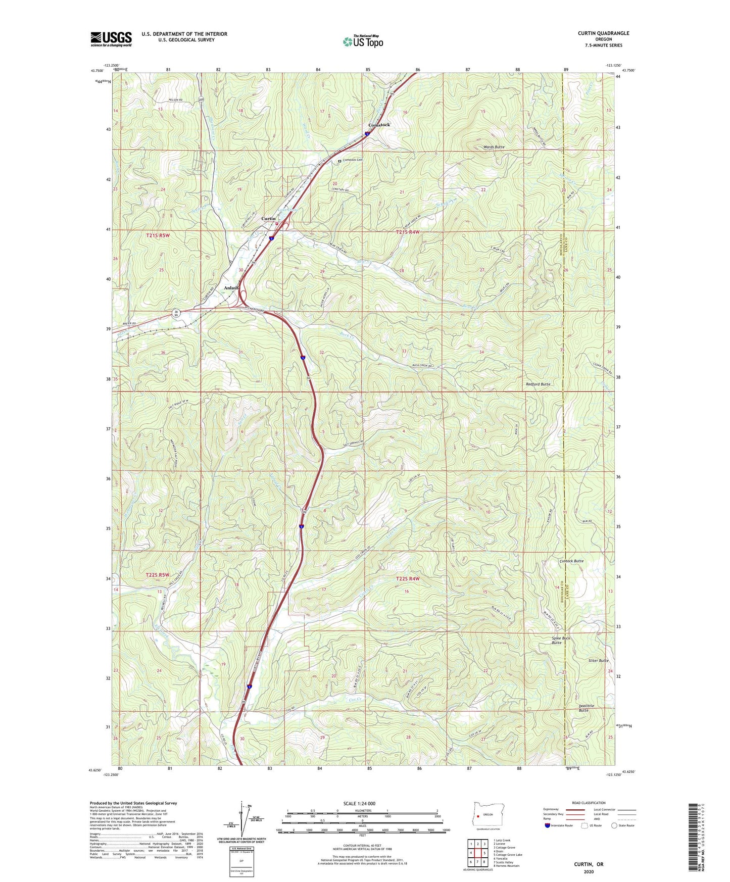
2023 topographic map quadrangle Curtin in the state of Oregon. Scale: 1:24000. Based on the newly updated USGS 7.5' US Topo map series, this map is in the following counties: Douglas, Lane. The map contains contour data, water features, and other items you are used to seeing on USGS maps, but also has updated roads and other features. This is the next generation of topographic maps. Printed on high-quality waterproof paper with UV fade-resistant inks.
Quads adjacent to this one:
West: Drain
Northwest: Letz Creek
North: Lorane
Northeast: Cottage Grove
East: Cottage Grove Lake
Southeast: Harness Mountain
South: Scotts Valley
Southwest: Yoncalla
This map covers the same area as the classic USGS quad with code o43123f2.
Contains the following named places: Anlauf, Anlauf Creek, Anlauf Post Office, Bear Creek, Buck Creek, Comstock, Comstock Cemetery, Comstock Post Office, Cox Creek, Curtin, Curtin Post Office, Curtis Creek, Cuttock Butte, Doolittle Butte, Gretna, Indian Burial Ground, Lake Diane, Lawrence Reservoir, Lees Creek, North Douglas County Fire and Emergency Medical Services Station 4, Pass Creek County Park, Pheasant Creek, Redford Butte, Salt Creek, Schafer Creek, Seeley Creek, Simpson Creek, Siuslaw, Sliter Butte, Spike Buck Butte, Ward Creek, Wards Butte, Wehmeyer Creek