MyTopo
Harrington Creek Oregon US Topo Map
Couldn't load pickup availability
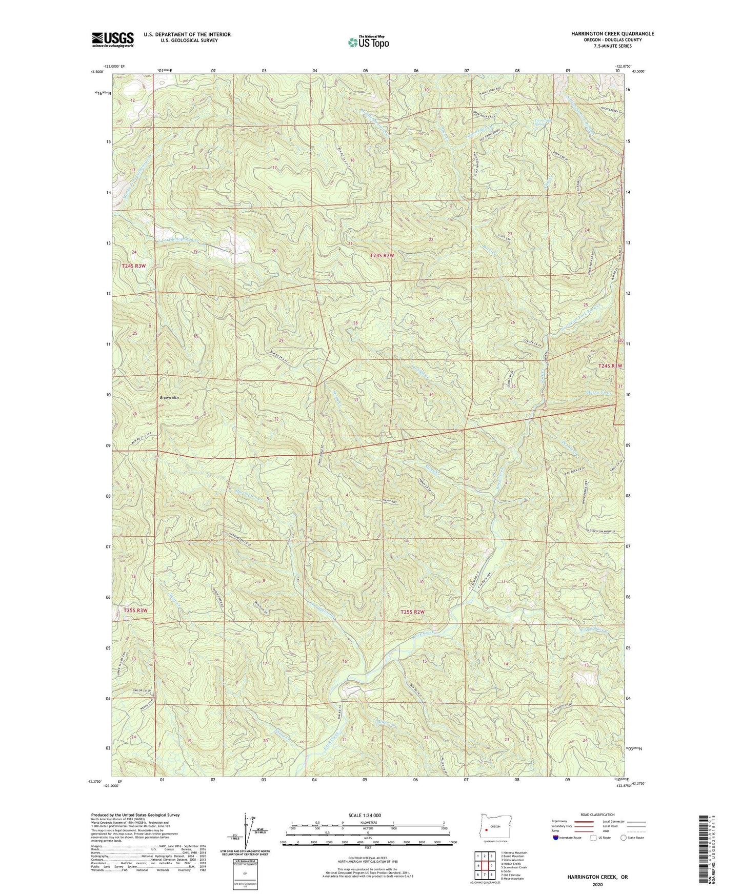
2023 topographic map quadrangle Harrington Creek in the state of Oregon. Scale: 1:24000. Based on the newly updated USGS 7.5' US Topo map series, this map is in the following counties: Douglas. The map contains contour data, water features, and other items you are used to seeing on USGS maps, but also has updated roads and other features. This is the next generation of topographic maps. Printed on high-quality waterproof paper with UV fade-resistant inks.
Quads adjacent to this one:
West: Hinkle Creek
Northwest: Harness Mountain
North: Burnt Mountain
Northeast: Silica Mountain
East: Scaredman Creek
Southeast: Mace Mountain
South: Old Fairview
Southwest: Glide
This map covers the same area as the classic USGS quad with code o43122d8.
Contains the following named places: Brown Mountain, Cleft Creek, Cobble Creek, East Fork Rock Creek, Harrington Creek, Huckleberry Creek, Hurry Up Creek, Middle Fork Calapooya Creek, Middle Mountain Creek, Miller Creek, Millpond Campground, Northeast Fork Rock Creek, Pebble Creek, Rock Creek Recreation Site, Shoup Creek, Stony Creek, Twin Cedar Creek, Twin Cedar Spring