MyTopo
Hay Lake Oregon US Topo Map
Couldn't load pickup availability
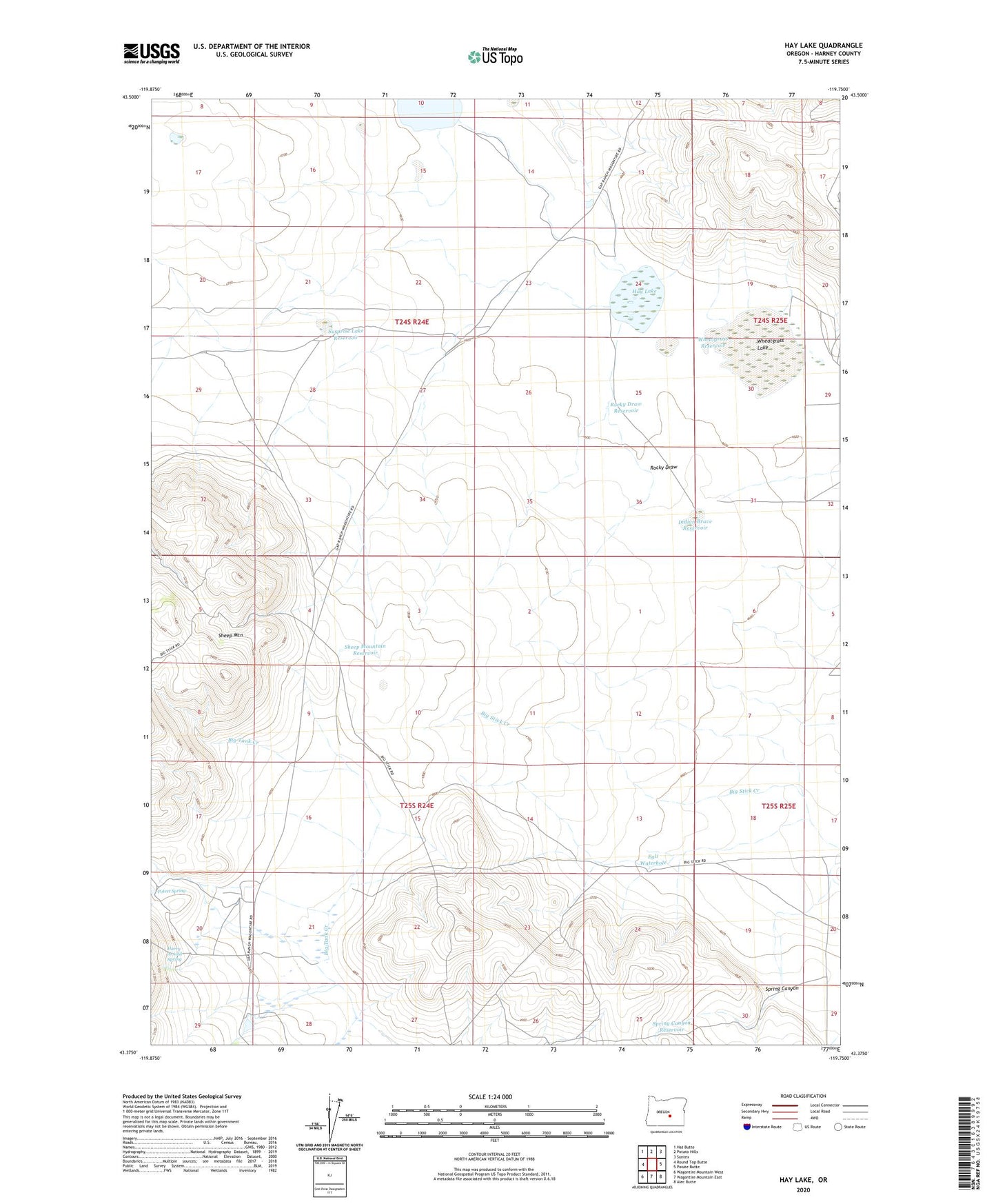
2023 topographic map quadrangle Hay Lake in the state of Oregon. Scale: 1:24000. Based on the newly updated USGS 7.5' US Topo map series, this map is in the following counties: Harney. The map contains contour data, water features, and other items you are used to seeing on USGS maps, but also has updated roads and other features. This is the next generation of topographic maps. Printed on high-quality waterproof paper with UV fade-resistant inks.
Quads adjacent to this one:
West: Round Top Butte
Northwest: Hat Butte
North: Potato Hills
Northeast: Suntex
East: Paiute Butte
Southeast: Alec Butte
South: Wagontire Mountain East
Southwest: Wagontire Mountain West
This map covers the same area as the classic USGS quad with code o43119d7.
Contains the following named places: Egli Waterhole, Harry Arnold Ranch, Harry Arnold Spring, Hay Lake, Hole in Ground, Indian Brave Reservoir, Old Egli Place, Poteet Spring, Rocky Draw, Rocky Draw Reservoir, Ryegrass Lake, Sheep Mountain Reservoir, Spring Canyon, Spring Canyon Reservoir, Surprise Lake Reservoir, Wheatgrass Lake, Wheatgrass Reservoir