
MyTopo
Hermiston Oregon US Topo Map
Couldn't load pickup availability
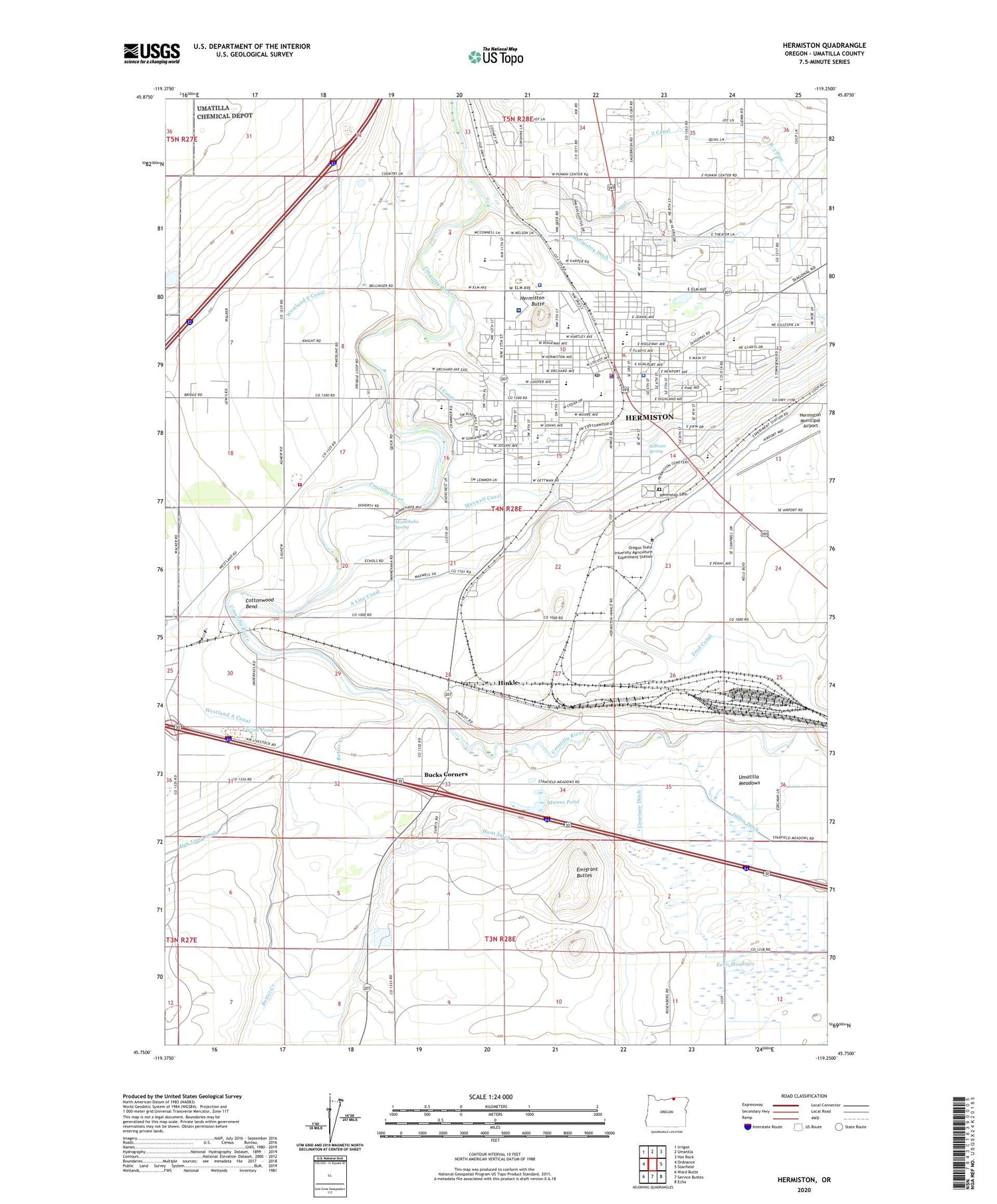
2020 topographic map quadrangle Hermiston in the state of Oregon. Scale: 1:24000. Based on the newly updated USGS 7.5' US Topo map series, this map is in the following counties: Umatilla. The map contains contour data, water features, and other items you are used to seeing on USGS maps, but also has updated roads and other features. This is the next generation of topographic maps. Printed on high-quality waterproof paper with UV fade-resistant inks.
Quads adjacent to this one:
West: Ordnance
Northwest: Irrigon
North: Umatilla
Northeast: Hat Rock
East: Stanfield
Southeast: Echo
South: Service Buttes
Southwest: Ward Butte
Contains the following named places: A Line Canal, Armand Larive Middle School, Belt Park, Bucks Corners, Butte Park, Butter Creek, Butter Creek Junction, City of Hermiston, Cornell Place, Cottonwood Bend, Courtney Ditch, Department of Motor Vehicles Hermiston, Desert View Elementary School, Dillon Ditch, Echo Meadows, Emigrant Buttes, Feed Canal, Good Shepherd Hospital Heliport, Good Shepherd Medical Center, Hermiston, Hermiston Butte, Hermiston Cemetery, Hermiston Christian Center and School, Hermiston City Hall, Hermiston Ditch, Hermiston Fire and Emergency Services Station 3, Hermiston Generating Project, Hermiston High School, Hermiston Junior Academy, Hermiston Municipal Airport, Hermiston Municipal Court, Hermiston Police Department, Hermiston Post Office, Hermiston Power Project, Hermiston Public Library, Hermiston Public Works Department, Hermiston Rodeo Grounds, Hermiston State Game Farm, Hermiston Wastewater Treatment Plant, Hermiston Water Treatment Facility, Hermiston-Umatilla Division, High Line Canal, Highland Hills Elementary School, Highland Park, Hinkle, Hinkle Yards, Hodge Park, I Canal, KOHU - AM, KOHU-FM, Manns Pond, Maxwell Canal, McKenzie Park, Meadows Post Office, Minnehaha Spring, N Canal, Newport Park, Northside Park, Oregon State Police Department Hermiston, Oregon State University Agriculture Experiment Station, R-3 Pipe, Riverfront Park, Rocky Heights Elementary School, Sandstone Middle School, Stanfield Safety Rest Area, Steelhead Park, Sullivan Spring, Sunset Elementary School, Sunset Park, Theater Sports Park, Top Cut Feedlot, Umatilla County Fairgrounds, Umatilla County Fire District 1 Station 21, Umatilla County Sheriff's Office Hermiston, Umatilla Meadows, Victory Square Park, Volunteer Park, West Park Elementary School, Westland, Westland A Canal, Westland F Canal, Westland Post Office, Wink Pond, Z Canal, ZIP Code: 97838


