MyTopo
Ordnance Oregon US Topo Map
Couldn't load pickup availability
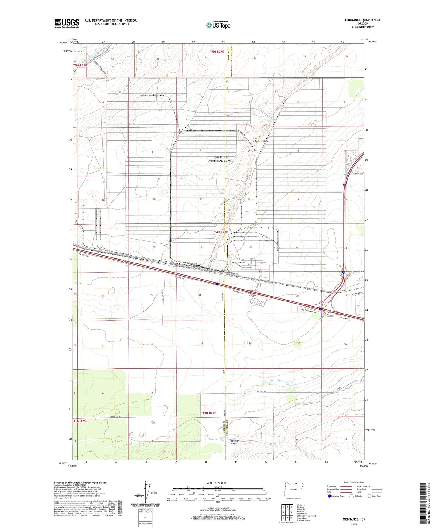
2024 topographic map quadrangle Ordnance in the state of Oregon. Scale: 1:24000. Based on the newly updated USGS 7.5' US Topo map series, this map is in the following counties: Umatilla, Morrow. The map contains contour data, water features, and other items you are used to seeing on USGS maps, but also has updated roads and other features. This is the next generation of topographic maps. Printed on high-quality waterproof paper with UV fade-resistant inks.
Quads adjacent to this one:
West: Clarke
Northwest: Paterson
North: Irrigon
Northeast: Umatilla
East: Hermiston
Southeast: Service Buttes
South: Ward Butte
Southwest: Strawberry Canyon NE
This map covers the same area as the classic USGS quad with code o45119g4.
Contains the following named places: Bannister Pit, Fourmile Canyon, Lost Lake, Munley, Ordnance, Ordnance Post Office, Umatilla Chemical Depot, Umatilla Chemical Depot Fire Department