MyTopo
Ward Butte Oregon US Topo Map
Couldn't load pickup availability
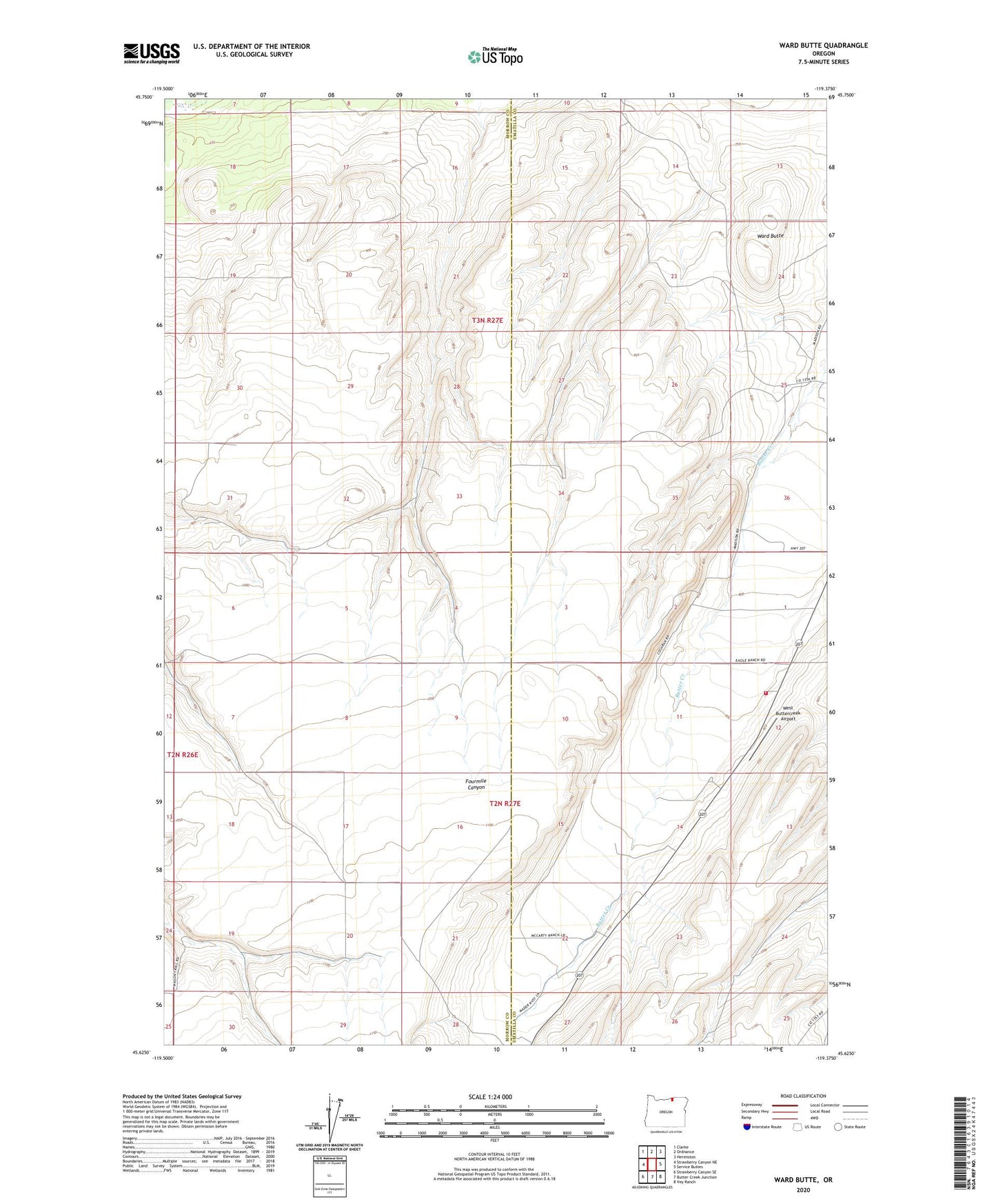
2023 topographic map quadrangle Ward Butte in the state of Oregon. Scale: 1:24000. Based on the newly updated USGS 7.5' US Topo map series, this map is in the following counties: Umatilla, Morrow. The map contains contour data, water features, and other items you are used to seeing on USGS maps, but also has updated roads and other features. This is the next generation of topographic maps. Printed on high-quality waterproof paper with UV fade-resistant inks.
Quads adjacent to this one:
West: Strawberry Canyon NE
Northwest: Clarke
North: Ordnance
Northeast: Hermiston
East: Service Buttes
Southeast: Vey Ranch
South: Butter Creek Junction
Southwest: Strawberry Canyon SE
This map covers the same area as the classic USGS quad with code o45119f4.
Contains the following named places: Echo Rural Fire Protection District Station 3, Four Corners, Ward Butte, West Buttercreek Airport