MyTopo
High Rock Oregon US Topo Map
Couldn't load pickup availability
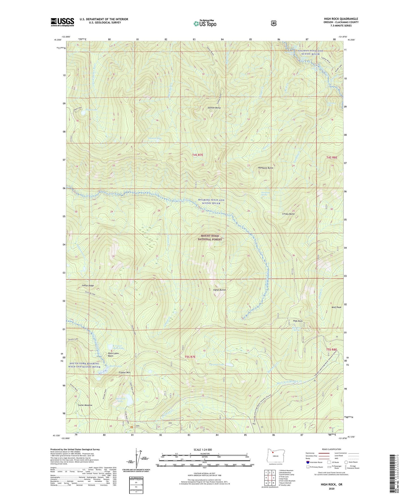
2020 topographic map quadrangle High Rock in the state of Oregon. Scale: 1:24000. Based on the newly updated USGS 7.5' US Topo map series, this map is in the following counties: Clackamas. The map contains contour data, water features, and other items you are used to seeing on USGS maps, but also has updated roads and other features. This is the next generation of topographic maps. Printed on high-quality waterproof paper with UV fade-resistant inks.
Quads adjacent to this one:
West: Three Lynx
Northwest: Wildcat Mountain
North: Rhododendron
Northeast: Government Camp
East: Wolf Peak
Southeast: Timothy Lake
South: Mount Mitchell
Southwest: Fish Creek Mountain
Contains the following named places: Black Wolf Meadow Creek, Cache Meadow, Cougar Creek, Final Falls, Frazier Fork Campground, Frazier Mountain, Frazier Turnaround Campground, Frustration Falls, Goat Creek, Hambone Butte, Hambone Spring, Hambone Springs Campground, Hambone Trail, Hideaway Falls, High Rock, High Rock Creek, High Rock Quarry, High Rock Spring, High Rock Spring Recreation Site, Indian Ridge, Iron Creek, Kinzel Creek, Linney Butte, Little Niagara Falls, Lower Rock Lake, Middle Rock Lake, Plaza Lake, Pyramid Lake, Roaring River Trail, Rock Lakes, Rock Lakes Basin, Round Wolf Pit, Salmon Butte, Salmon Butte Trail, Salmon Lake, Salmon Wild and Scenic River, Shellrock Lake, Signal Buttes, Sink Quarry, South Fork Ridge Trail, Splintercat Creek, Swift Creek, Tumbling Creek, Upper Rock Lake, Vanishing Falls