MyTopo
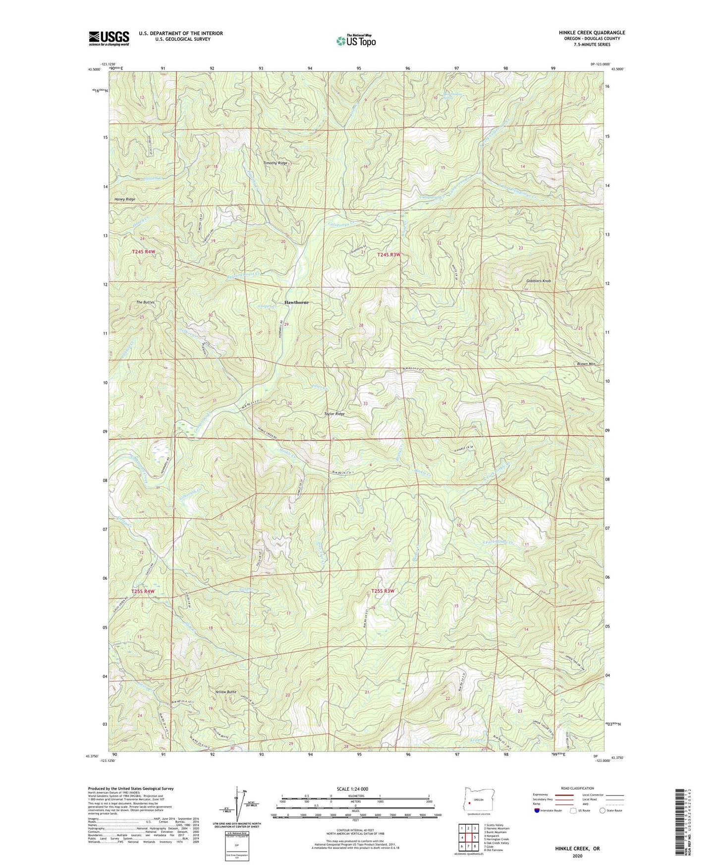
Hinkle Creek Oregon US Topo Map
Couldn't load pickup availability
2020 topographic map quadrangle Hinkle Creek in the state of Oregon. Scale: 1:24000. Based on the newly updated USGS 7.5' US Topo map series, this map is in the following counties: Douglas. The map contains contour data, water features, and other items you are used to seeing on USGS maps, but also has updated roads and other features. This is the next generation of topographic maps. Printed on high-quality waterproof paper with UV fade-resistant inks.
Quads adjacent to this one:
West: Nonpareil
Northwest: Scotts Valley
North: Harness Mountain
Northeast: Burnt Mountain
East: Harrington Creek
Southeast: Old Fairview
South: Glide
Southwest: Oak Creek Valley
Contains the following named places: Bear Wallow Spring, Beaty Creek, Belmont Post Office, Brome Creek, Buzzard Roost Creek, Coon Creek, Cooper Creek, Field Creek, Filler Creek, Gilbreath Creek, Gobblers Knob, Haney Ridge, Hawthorne, Hawthorne Post Office, Hinkle Creek, Jeffers Creek, North Fork Calapooya Creek, North Fork Hinkle Creek, Pike Creek, Pine Tree Creek, Slide Creek, South Fork Calapooya Creek, South Fork Hinkle Creek, Taylor Ridge, The Buttes, Timothy Creek, Timothy Ridge, White Creek, Yellow Butte