MyTopo
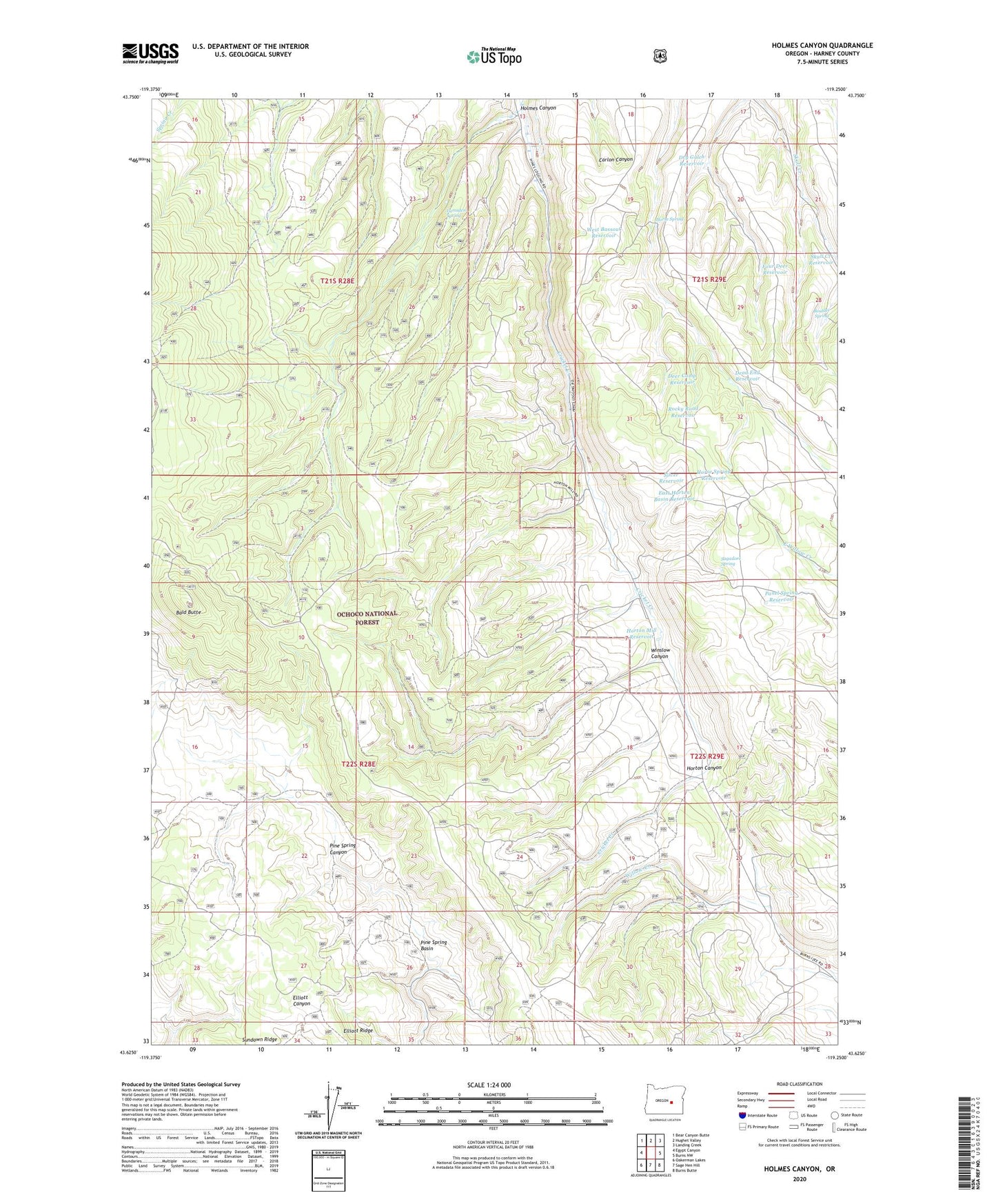
Holmes Canyon Oregon US Topo Map
Couldn't load pickup availability
Also explore the Holmes Canyon Forest Service Topo of this same quad for updated USFS data
2024 topographic map quadrangle Holmes Canyon in the state of Oregon. Scale: 1:24000. Based on the newly updated USGS 7.5' US Topo map series, this map is in the following counties: Harney. The map contains contour data, water features, and other items you are used to seeing on USGS maps, but also has updated roads and other features. This is the next generation of topographic maps. Printed on high-quality waterproof paper with UV fade-resistant inks.
Quads adjacent to this one:
West: Egypt Canyon
Northwest: Bear Canyon Butte
North: Hughet Valley
Northeast: Landing Creek
East: Burns NW
Southeast: Burns Butte
South: Sage Hen Hill
Southwest: Oakerman Lakes
This map covers the same area as the classic USGS quad with code o43119f3.
Contains the following named places: Bald Butte, Boulder Spring, Dead End Reservoir, Deer Camp Reservoir, Dry Gulch Reservoir, East Horton Basin Reservoir, Elliott Ridge, Four Deer Reservoir, Holmes Canyon, Horse Spring, Horse Spring Reservoir, Horton Canyon, Horton Mill Reservoir, Lumsden Spring, Old Horton Mill, Panel Spring Reservoir, Pine Spring Basin, Rock Creek Dam, Rocky Road Reservoir, Sagadore Spring, Silver Reservoir, Skull Creek Reservoir, West Bassout Reservoir, Winslow Canyon