MyTopo
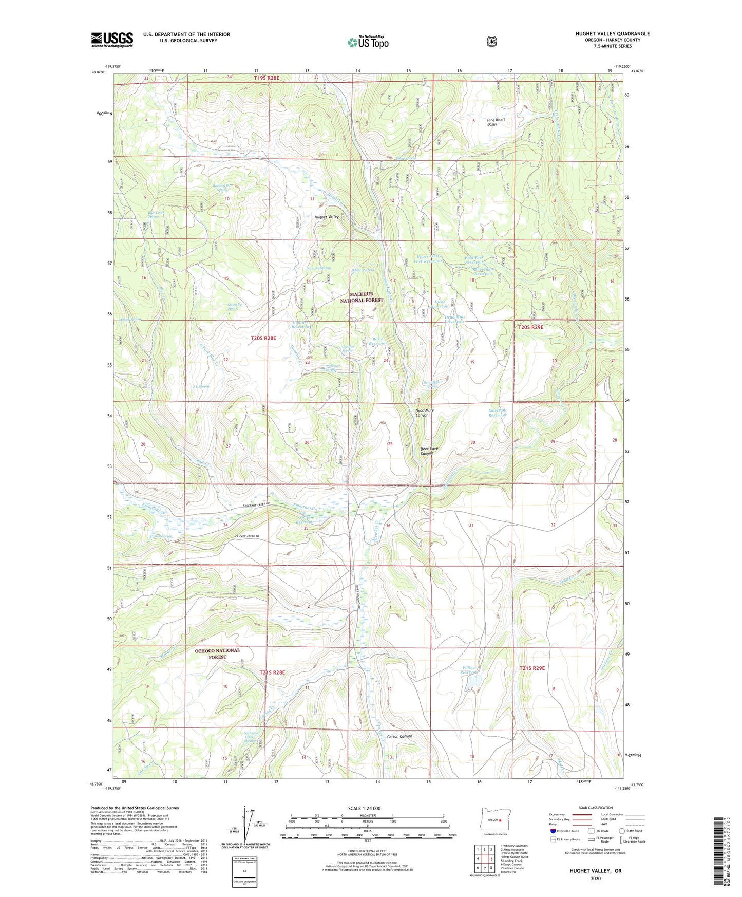
Hughet Valley Oregon US Topo Map
Couldn't load pickup availability
Also explore the Hughet Valley Forest Service Topo of this same quad for updated USFS data
2023 topographic map quadrangle Hughet Valley in the state of Oregon. Scale: 1:24000. Based on the newly updated USGS 7.5' US Topo map series, this map is in the following counties: Harney. The map contains contour data, water features, and other items you are used to seeing on USGS maps, but also has updated roads and other features. This is the next generation of topographic maps. Printed on high-quality waterproof paper with UV fade-resistant inks.
Quads adjacent to this one:
West: Bear Canyon Butte
Northwest: Whiskey Mountain
North: Alsup Mountain
Northeast: West Myrtle Butte
East: Landing Creek
Southeast: Burns NW
South: Holmes Canyon
Southwest: Egypt Canyon
This map covers the same area as the classic USGS quad with code o43119g3.
Contains the following named places: Basin Reservoir, Beaverdam Creek, Beaverdam Reservoir, Beaverdam Trail, Blue Creek, Blue Creek Spring, Blue Creek Work Center, Campbell Ranch, Carlon Canyon, Carlon Ranch, Carlon Spring, Cricket Creek, Dead Mule Canyon, Dead Mule Reservoir, Dead Mule Spring, Deer Cave Canyon, Dicks Reservoir, Dunn Ranch, East Fork Blue Creek, East Fork Reservoir, Emigrant Reservoir, Finke Spring, Gunther Creek, Gunther Reservoir, Gunther Spring, Horse Spring Canyon, Hughet Creek, Hughet Valley, Hunter Spring, J L Spring, Lower Buttes Reservoir, Middle Fork Reservoir, Mosier Spring, No Name Reservoir, Pine Knoll Basin, Professor Spring, Ramsey Ranch, Ramsey Spring, Rocking Bar Spring, Sawtooth Creek, Seven Up Spring, Smith Reservoir, Spring Creek, Spring Creek Spring, Stinger Creek, Turner Ranch, Upper West Fork Reservoir, West Fork Reservoir, Willow Reservoir, Yellowjacket Trail