MyTopo
Imperial Valley South Oregon US Topo Map
Couldn't load pickup availability
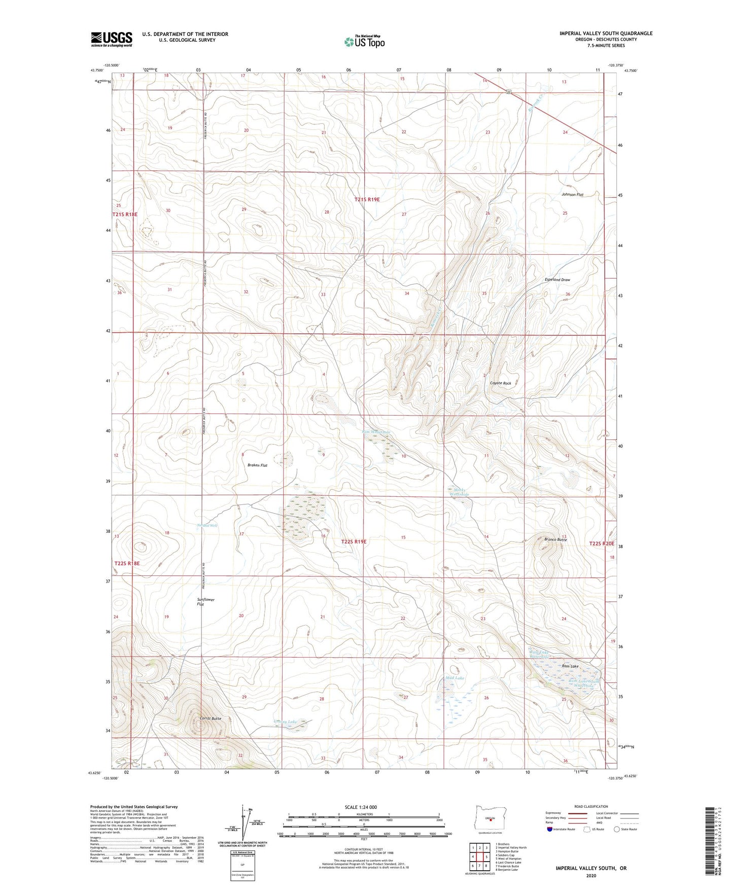
2024 topographic map quadrangle Imperial Valley South in the state of Oregon. Scale: 1:24000. Based on the newly updated USGS 7.5' US Topo map series, this map is in the following counties: Deschutes. The map contains contour data, water features, and other items you are used to seeing on USGS maps, but also has updated roads and other features. This is the next generation of topographic maps. Printed on high-quality waterproof paper with UV fade-resistant inks.
Quads adjacent to this one:
West: Soldiers Cap
Northwest: Brothers
North: Imperial Valley North
Northeast: Hampton Butte
East: West of Hampton
Southeast: Benjamin Lake
South: Frederick Butte
Southwest: Last Chance Lake
This map covers the same area as the classic USGS quad with code o43120f4.
Contains the following named places: Braken Flat, Bronco Butte, Burns Well, Cody Well, Corral Butte, Coyote Rock, Dominick Well, Espeland Draw, Grassy Lake, Imperial, Imperial Post Office, Johnson Flat, Meeks Waterhole, Mud Lake, Nershal Well, Peters Well, Ram Lake, Ram Lake South Waterhole, Ram Lake Waterhole, Rim Waterhole, Rimrock Creek, Skull Lake, Sunflower Flat, Sunflower Lake