MyTopo
Izee Oregon US Topo Map
Couldn't load pickup availability
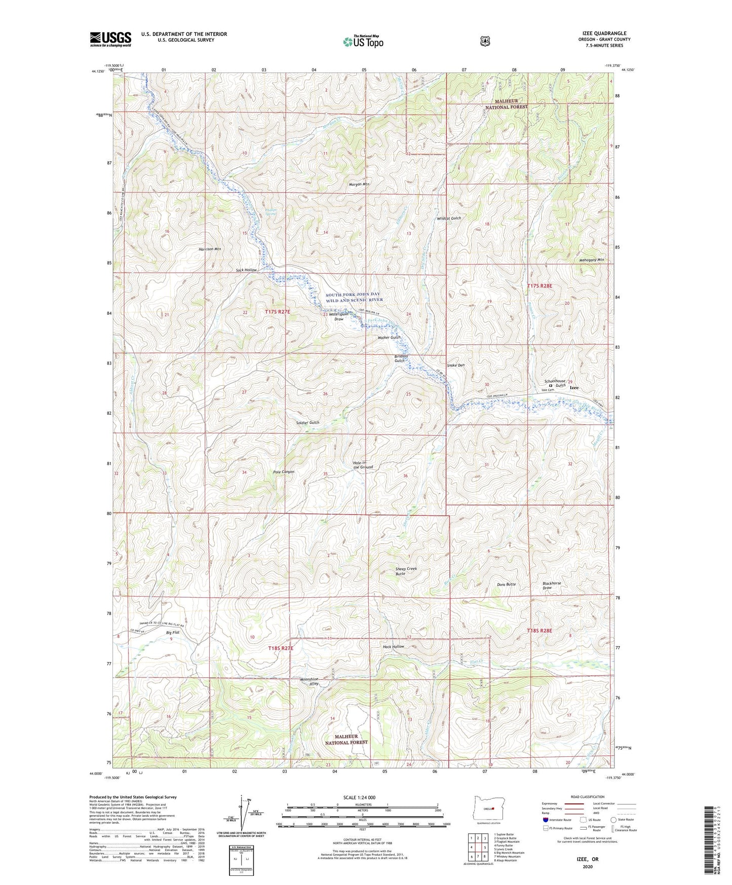
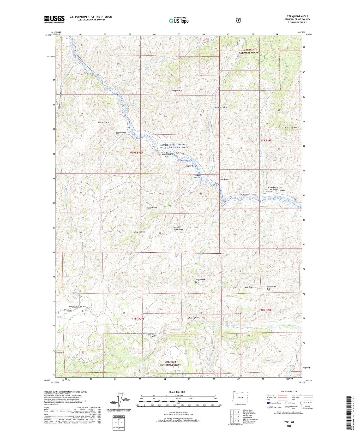
2020 topographic map quadrangle Izee in the state of Oregon. Scale: 1:24000. Based on the newly updated USGS 7.5' US Topo map series, this map is in the following counties: Grant. The map contains contour data, water features, and other items you are used to seeing on USGS maps, but also has updated roads and other features. This is the next generation of topographic maps. Printed on high-quality waterproof paper with UV fade-resistant inks.
Quads adjacent to this one:
West: Funny Butte
Northwest: Suplee Butte
North: Graylock Butte
Northeast: Flagtail Mountain
East: Lewis Creek
Southeast: Alsup Mountain
South: Whiskey Mountain
Southwest: Big Mowich Mountain
Contains the following named places: Alder Creek, Big Flat, Brisbois Creek, Brisbois Gulch, Brisbois Ranch, Buck Creek, Bush Mill, Davis Ranch, Dons Butte, Dry Soda Creek, Elkhorn Creek, Hack Hollow, Harrison Mountain, Hole-in-the Ground, Izee, Izee Cemetery, Izee Post Office, Keerins Ranch, Magill Creek, Mahogany Mountain, McCoy Creek, Moonshine Alley, Morgan Creek, Morgan Mountain, Phillips Ranch, Phillips Spring, Pine Creek, Poison Creek, Pole Canyon, Rosebud Creek, Schoolhouse Gulch, Sheep Creek, Sheep Creek Butte, Smith Ranch, Snake Den, Sock Hollow, Soldier Gulch, Spoon Creek, Walker Gulch, Waterspout Draw, Wildcat Gulch, ZIP Code: 97820