MyTopo
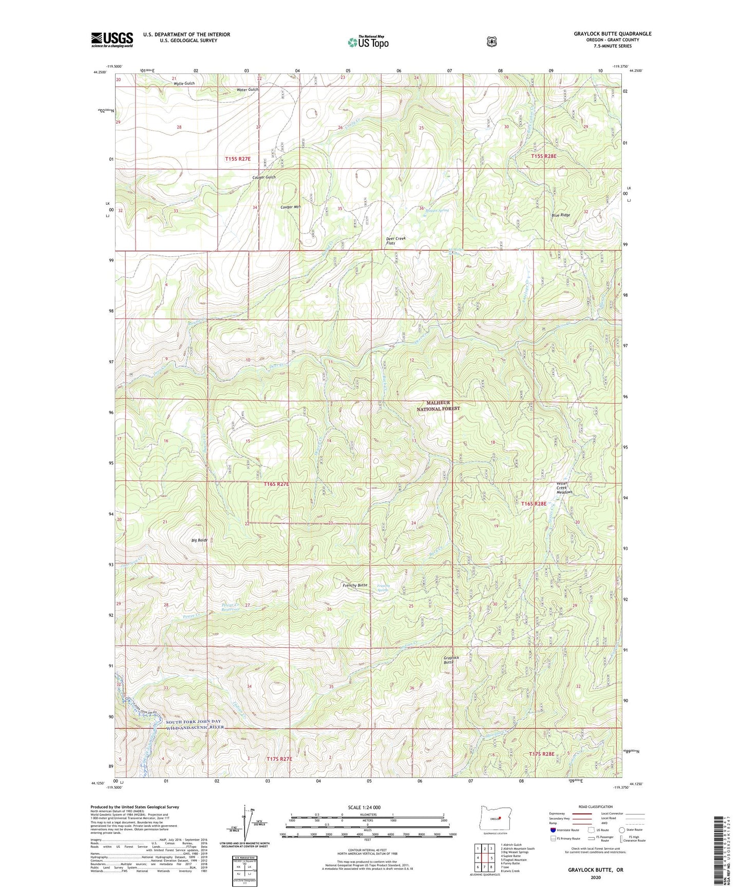
Graylock Butte Oregon US Topo Map
Couldn't load pickup availability
Also explore the Graylock Butte Forest Service Topo of this same quad for updated USFS data
2023 topographic map quadrangle Graylock Butte in the state of Oregon. Scale: 1:24000. Based on the newly updated USGS 7.5' US Topo map series, this map is in the following counties: Grant. The map contains contour data, water features, and other items you are used to seeing on USGS maps, but also has updated roads and other features. This is the next generation of topographic maps. Printed on high-quality waterproof paper with UV fade-resistant inks.
Quads adjacent to this one:
West: Suplee Butte
Northwest: Aldrich Gulch
North: Aldrich Mountain South
Northeast: Big Weasel Springs
East: Flagtail Mountain
Southeast: Lewis Creek
South: Izee
Southwest: Funny Butte
This map covers the same area as the classic USGS quad with code o44119b4.
Contains the following named places: Antelope Creek, Big Baldy, Blue Creek, Buck Creek, Camp Faraway, Cougar Mountain, Deer Creek Flats, Dewey Creek, Dry Pine Creek, Dugout Creek, Frenchy Butte, Frenchy Spring, Graylock Butte, Indian Creek, Maggot Spring, McMullen Spring, Pewee Creek, Pewee Creek Reservoir, Round Creek, Vester Creek, Vester Creek Meadows