MyTopo
Suplee Butte Oregon US Topo Map
Couldn't load pickup availability
Also explore the Suplee Butte Forest Service Topo of this same quad for updated USFS data
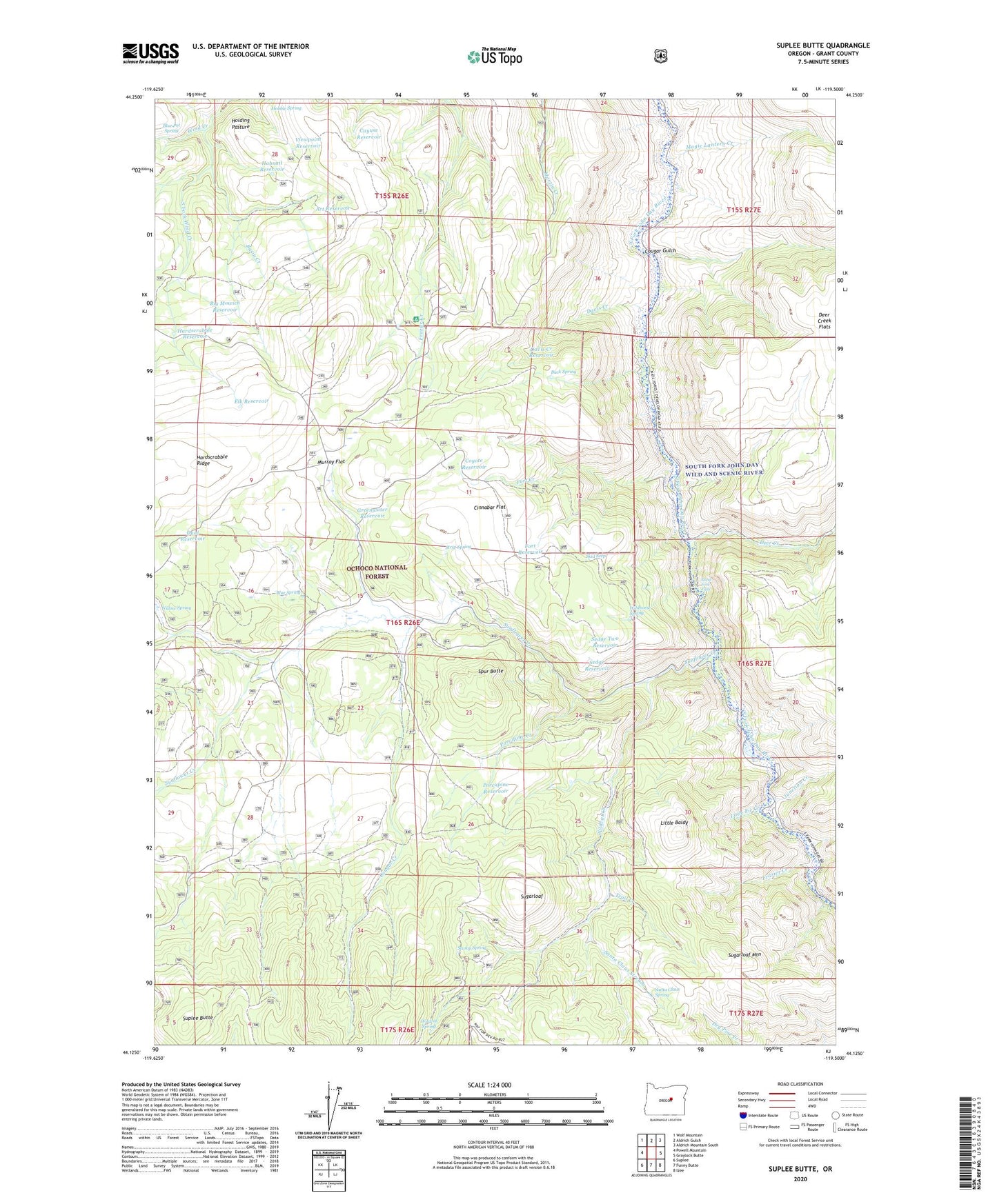
2023 topographic map quadrangle Suplee Butte in the state of Oregon. Scale: 1:24000. Based on the newly updated USGS 7.5' US Topo map series, this map is in the following counties: Grant. The map contains contour data, water features, and other items you are used to seeing on USGS maps, but also has updated roads and other features. This is the next generation of topographic maps. Printed on high-quality waterproof paper with UV fade-resistant inks.
Quads adjacent to this one:
West: Powell Mountain
Northwest: Wolf Mountain
North: Aldrich Gulch
Northeast: Aldrich Mountain South
East: Graylock Butte
Southeast: Izee
South: Funny Butte
Southwest: Suplee
This map covers the same area as the classic USGS quad with code o44119b5.
Contains the following named places: Art Reservoir, Basin Creek, Bernard Mill, Big Mowich Reservoir, Blue Pot Spring, Blue Spring, Buck Spring, Cayuse Reservoir, Cinnabar Flat, Cougar Creek, Cougar Gulch, Coyote Reservoir, Davis Creek, Davis Creek Reservoir, Deer Creek, Delore Place, Dual Reservoir, Elk Reservoir, Ellingson Mill, Fort Creek, Fort Reservoir, Frazier Creek, Frazier Recreation Site, Greenwater Reservoir, Hardscrabble Reservoir, Hobble Spring, Hobnail Reservoir, Holding Pasture, Junction Creek, Little Baldy, Little Fir Creek, Little Frazier Creek, Magic Lantern Creek, Murray Flat, Negro Cabin, Porcupine Creek, Porcupine Reservoir, Rail Ridge, Robinson Homestead, Santa Claus Spring, Santa Claus Stream, Sedge Reservoir, Sedge Two Reservoir, Skid Seep, South Fork Falls, South Fork John Day Wild and Scenic River, South Fork Wind Creek, Spur Butte, Strip Spring, Stump Spring, Sugarloaf, Sugarloaf Mountain, Sunflower Creek, Suplee Butte, Trail Creek, Viewpoint Reservoir, Wildcat Creek, Wildcat Spring, Wildhorse Falls Reservoir, Wildhorse Reservoir, Wildhorse Spring, Willow Spring