
MyTopo
Jaynes Ridge Oregon US Topo Map
Couldn't load pickup availability
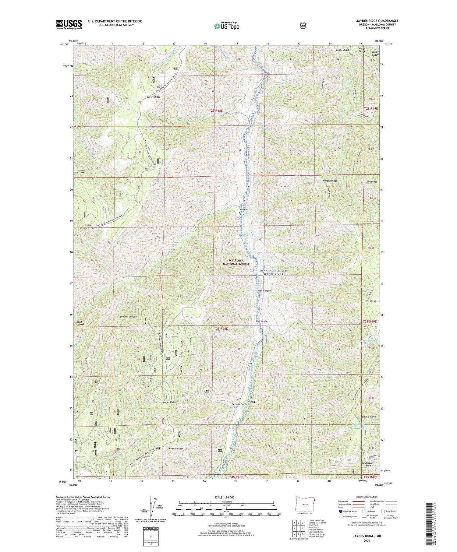
2020 topographic map quadrangle Jaynes Ridge in the state of Oregon. Scale: 1:24000. Based on the newly updated USGS 7.5' US Topo map series, this map is in the following counties: Wallowa. The map contains contour data, water features, and other items you are used to seeing on USGS maps, but also has updated roads and other features. This is the next generation of topographic maps. Printed on high-quality waterproof paper with UV fade-resistant inks.
Quads adjacent to this one:
West: Harl Butte
Northwest: Clear Lake Ridge
North: Sheep Creek Divide
Northeast: Hat Point
East: Squirrel Prairie
Southeast: White Monument
South: Puderbaugh Ridge
Southwest: Gumboot Butte
Contains the following named places: Balter Creek, Beeler Creek, Grouse Creek, Himmelwright Spring, Imnaha Grange, Imnaha River Woods Development, Jaynes Ridge, Jimmy Creek, Johnson Creek, Leggett Gulch, Lieutenant Creek, Line Creek, Makin Creek, Morgan Ridge, Musty Creek, Needham Gulch, Needham Pond, Neil Canyon, Neil Creek, Park Cemetery, Park Creek, Ralph Spring, Rich Creek, Road Canyon, Saddle Gulch, Saulsberry Saddle, Shadow Canyon, Shin Creek, Summit Creek, Summit Creek Trail, Tepee Spring, The Park School, The Saddle, Trail Creek, Winston Creek


