MyTopo
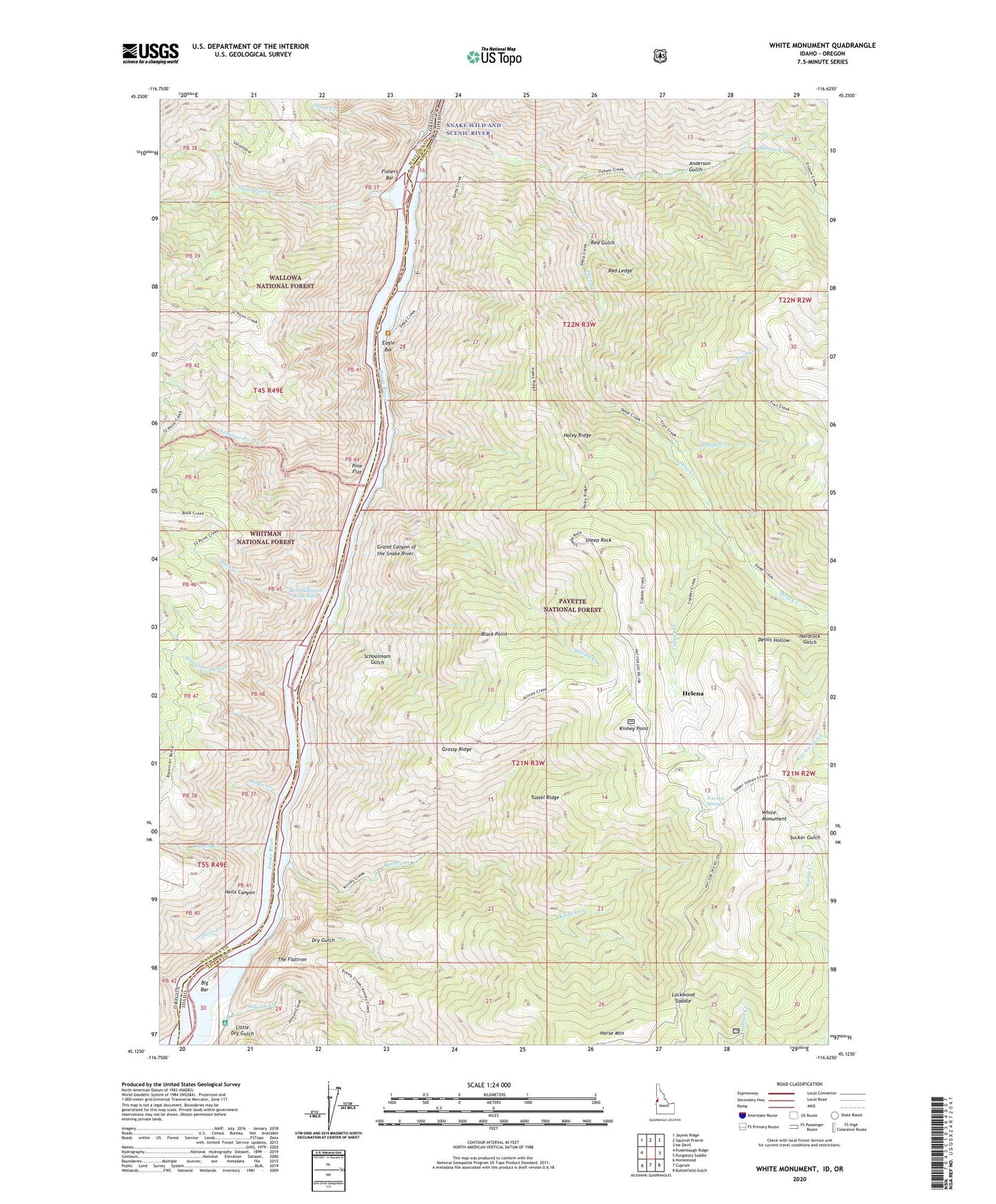
White Monument Idaho US Topo Map
Couldn't load pickup availability
Also explore the White Monument Forest Service Topo of this same quad for updated USFS data
2024 topographic map quadrangle White Monument in the states of Idaho, Oregon. Scale: 1:24000. Based on the newly updated USGS 7.5' US Topo map series, this map is in the following counties: Adams, Wallowa. The map contains contour data, water features, and other items you are used to seeing on USGS maps, but also has updated roads and other features. This is the next generation of topographic maps. Printed on high-quality waterproof paper with UV fade-resistant inks.
Quads adjacent to this one:
West: Puderbaugh Ridge
Northwest: Jaynes Ridge
North: Squirrel Prairie
Northeast: He Devil
East: Purgatory Saddle
Southeast: Butterfield Gulch
South: Cuprum
Southwest: Homestead
Contains the following named places: Alaska Mine, Allison Creek, Anderson Gulch, Big Bar, Black Point, Bluejacket Mine, Buck Creek, Copper Creek, Deep Creek, Devils Hollow, Dove Creek, Dove Creek Campground, Doyle Creek, Dry Gulch, Eagle Bar, Fishers Bar, Grassy Ridge, Haley Ridge, Hardrock Gulch, Heady Creek, Helena, Helena Post Office, Hells Canyon Dam, Hells Canyon Reservoir, Howell, Ipsus time Creek, Kinney Creek, Kinney Point, Kirby Creek, Little Dry Gulch, Lockwood Saddle, Lynch Creek, Lynch Creek Forest Camp, Lynes Ranch, Oxbow Creek, Pine Flat, Red Gulch, Red Ledge, Red Ledge Mine, Red Ledge Trail, Sawpit Creek, Schoolmam Gulch, Sheep Rock, Sheep Rock National Recreation Trail, Sheep Rock Overlook, Short Creek, South Peacock Mine, Steamboat Creek, Sucker Gulch, The Flatiron, Thirtytwo Point Creek, Towsley Spring, Trail Creek, Tussel Ridge, Vermillion Bar Campground, White Monument