MyTopo
Juniper Mountain Oregon US Topo Map
Couldn't load pickup availability
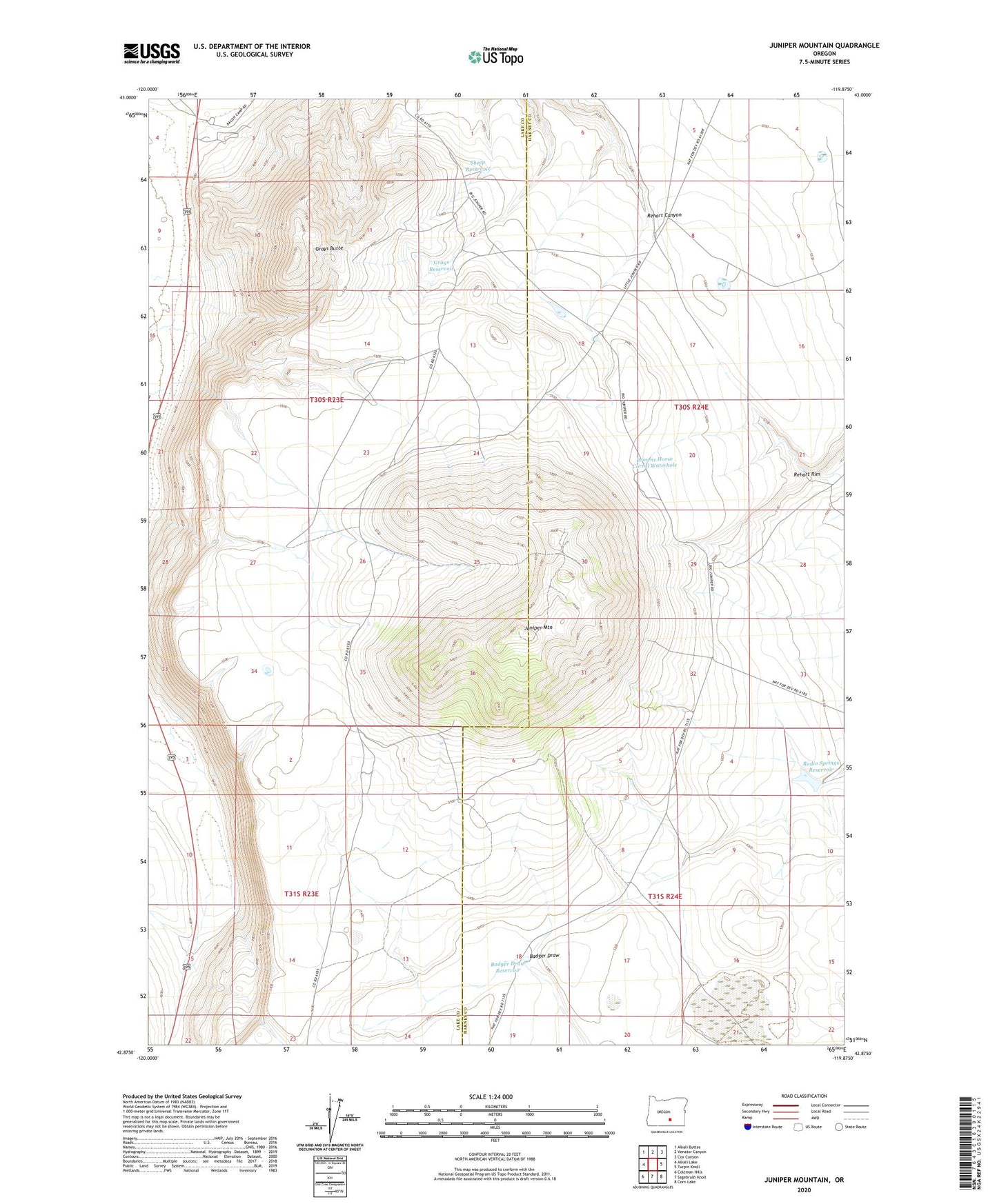
2023 topographic map quadrangle Juniper Mountain in the state of Oregon. Scale: 1:24000. Based on the newly updated USGS 7.5' US Topo map series, this map is in the following counties: Lake, Harney. The map contains contour data, water features, and other items you are used to seeing on USGS maps, but also has updated roads and other features. This is the next generation of topographic maps. Printed on high-quality waterproof paper with UV fade-resistant inks.
Quads adjacent to this one:
West: Alkali Lake
Northwest: Alkali Buttes
North: Venator Canyon
Northeast: Cox Canyon
East: Turpin Knoll
Southeast: Corn Lake
South: Sagebrush Knoll
Southwest: Coleman Hills
This map covers the same area as the classic USGS quad with code o42119h8.
Contains the following named places: Alkali Lake Station, Badger Draw Reservoir, Browns Horse Corral Waterhole, Grays Butte, Grays Reservoir, Juniper Mountain, Radio Springs Reservoir, Sheep Reservoir