MyTopo
Corn Lake Oregon US Topo Map
Couldn't load pickup availability
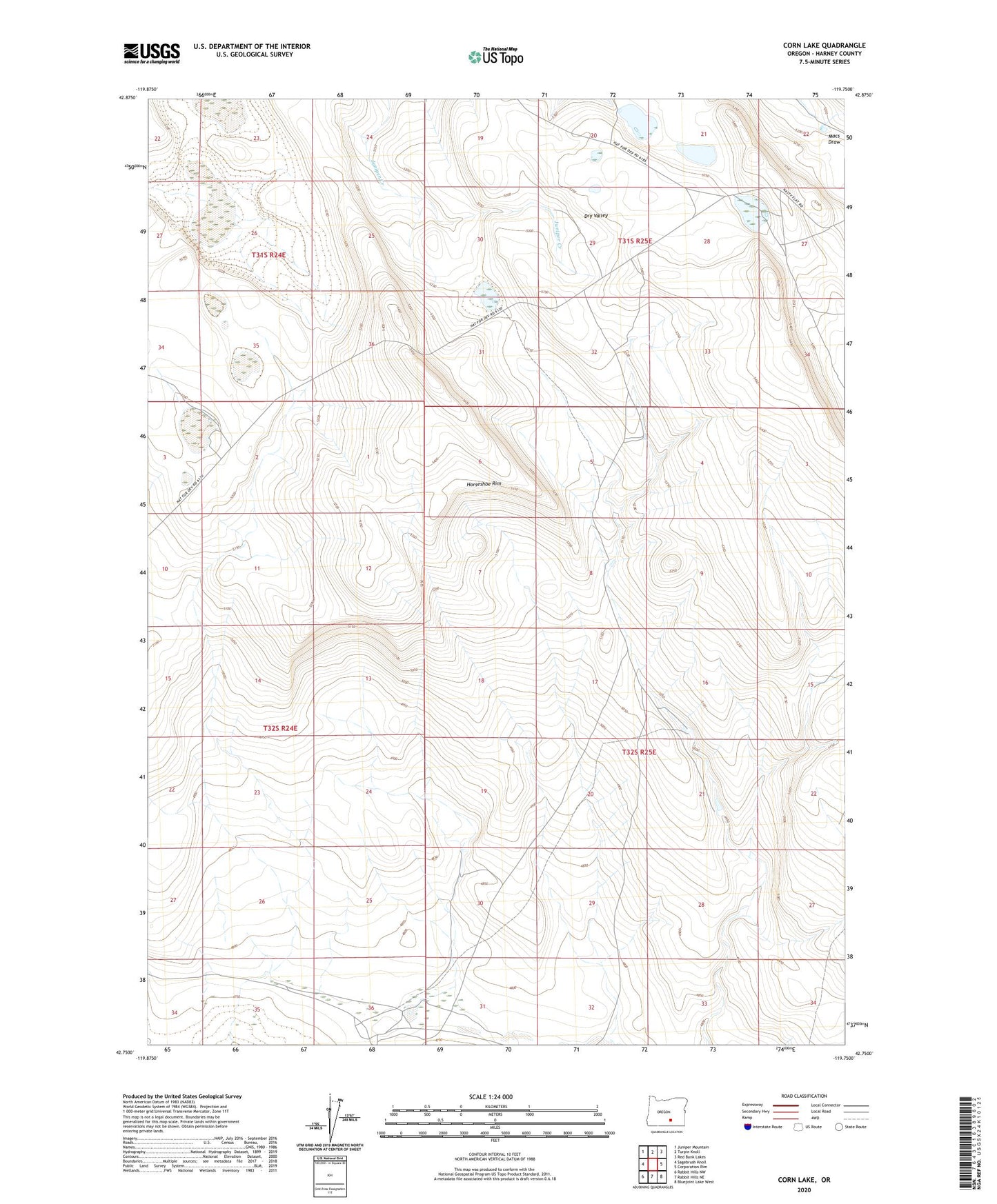
2023 topographic map quadrangle Corn Lake in the state of Oregon. Scale: 1:24000. Based on the newly updated USGS 7.5' US Topo map series, this map is in the following counties: Harney. The map contains contour data, water features, and other items you are used to seeing on USGS maps, but also has updated roads and other features. This is the next generation of topographic maps. Printed on high-quality waterproof paper with UV fade-resistant inks.
Quads adjacent to this one:
West: Sagebrush Knoll
Northwest: Juniper Mountain
North: Turpin Knoll
Northeast: Red Bank Lakes
East: Corporation Rim
Southeast: Bluejoint Lake West
South: Rabbit Hills NE
Southwest: Rabbit Hills NW
This map covers the same area as the classic USGS quad with code o42119g7.
Contains the following named places: Horseshoe Rim