
MyTopo
Kinzua Oregon US Topo Map
Couldn't load pickup availability
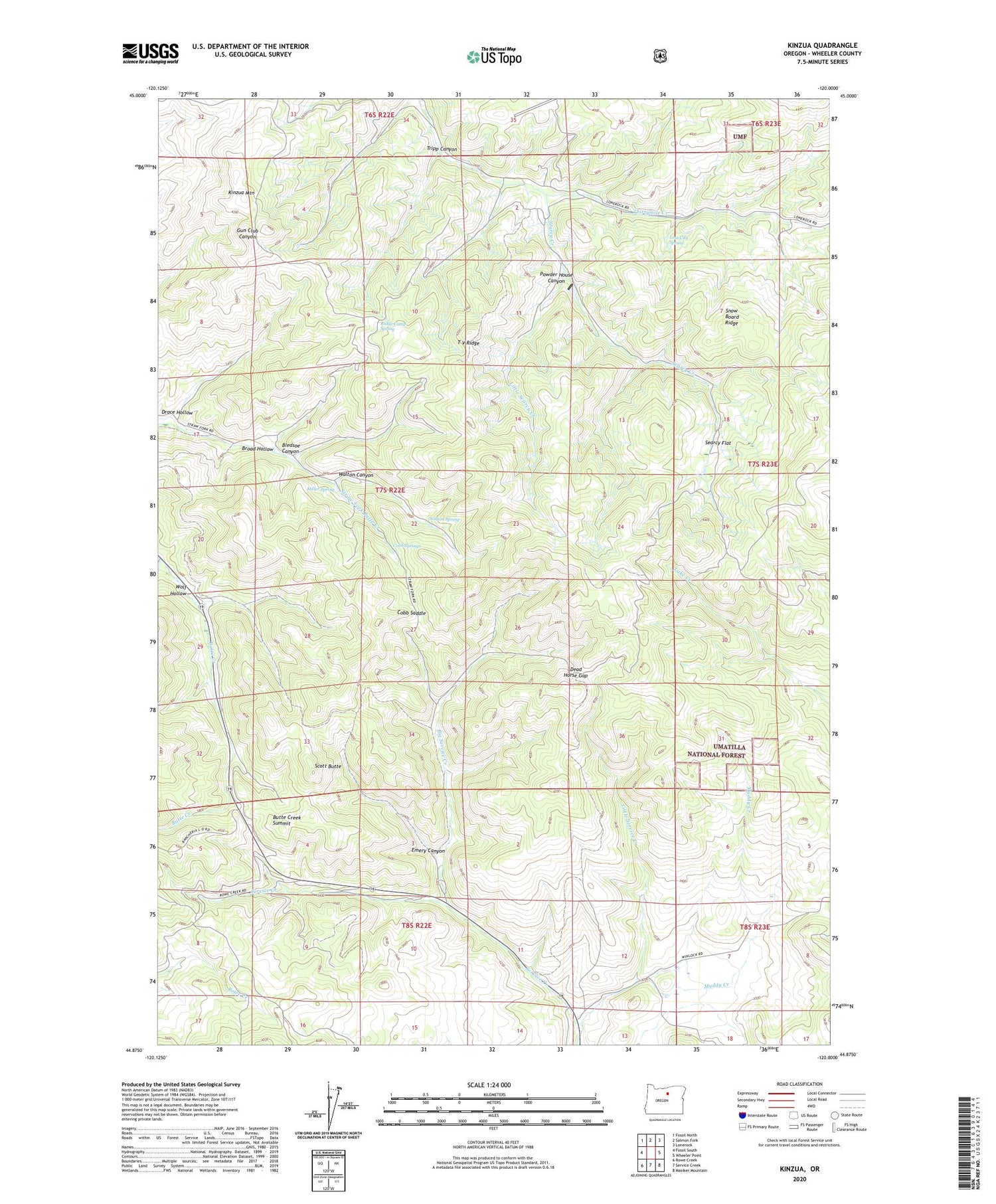
2020 topographic map quadrangle Kinzua in the state of Oregon. Scale: 1:24000. Based on the newly updated USGS 7.5' US Topo map series, this map is in the following counties: Wheeler. The map contains contour data, water features, and other items you are used to seeing on USGS maps, but also has updated roads and other features. This is the next generation of topographic maps. Printed on high-quality waterproof paper with UV fade-resistant inks.
Quads adjacent to this one:
West: Fossil South
Northwest: Fossil North
North: Salmon Fork
Northeast: Lonerock
East: Wheeler Point
Southeast: Masiker Mountain
South: Service Creek
Southwest: Rowe Creek
Contains the following named places: Bear Hollow County Park, Big Service Creek, Bledsoe Canyon, Broad Hollow, Butte Creek Summit, Cobb Saddle, Cobb Springs, Dead Horse Gap, Emery Canyon, Hells Half Acre, Julia A Henderson Pioneer Park, Kinzua, Kinzua Dam, Kinzua Mountain, Kinzua Post Office, Kinzua Reservoir, Little Searcy Creek, Little Service Creek, Lost City Spring, Miller Spring, Muddy Creek, Powder House Canyon, Prairie Ranch, Ridge Camp Spring, Scott Butte, Searcy Creek, Searcy Flat, Shelton Wayside County Park, T V Ridge, Tripp Canyon, Walton Canyon, Walton Spring, Wolf Hollow


