MyTopo
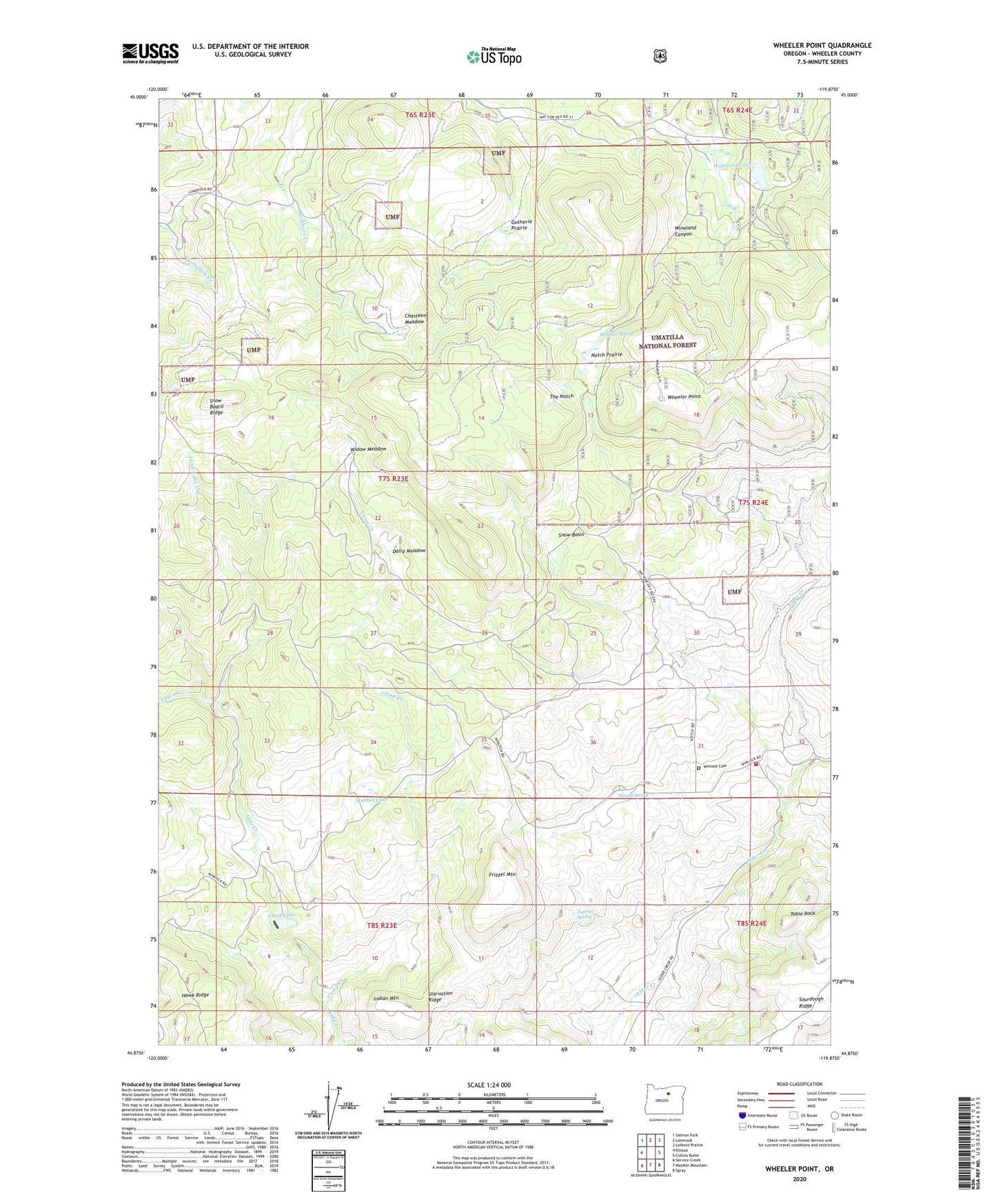
Wheeler Point Oregon US Topo Map
Couldn't load pickup availability
Also explore the Wheeler Point Forest Service Topo of this same quad for updated USFS data
2023 topographic map quadrangle Wheeler Point in the state of Oregon. Scale: 1:24000. Based on the newly updated USGS 7.5' US Topo map series, this map is in the following counties: Wheeler. The map contains contour data, water features, and other items you are used to seeing on USGS maps, but also has updated roads and other features. This is the next generation of topographic maps. Printed on high-quality waterproof paper with UV fade-resistant inks.
Quads adjacent to this one:
West: Kinzua
Northwest: Salmon Fork
North: Lonerock
Northeast: Lefevre Prairie
East: Collins Butte
Southeast: Spray
South: Masiker Mountain
Southwest: Service Creek
This map covers the same area as the classic USGS quad with code o44119h8.
Contains the following named places: Camp Creek, Chasteen Meadow, Clark Lake, Clark Lake Dam, Dairy Meadow, Frizzel Mountain, Gutherie Prairie, Howell Spring, Hubbel Lake, Indian Mountain, Little Lake Creek, Meadow Spring, Notch Prairie, Reservoir Number One, Reservoir Number Three, Reservoir Number Two, Sigerist Spring, Snow Basin, Snow Board Ridge, Sourdough Ridge, Starvation Ridge, Table Rock, The Notch, Wetmore, Wetmore Post Office, Wheeler Creek, Wheeler Point, Wheeler Point Volunteer Fire Department, Widow Meadow, Wineland Lake, Winlock, Winlock Cemetery, Winlock Post Office