MyTopo
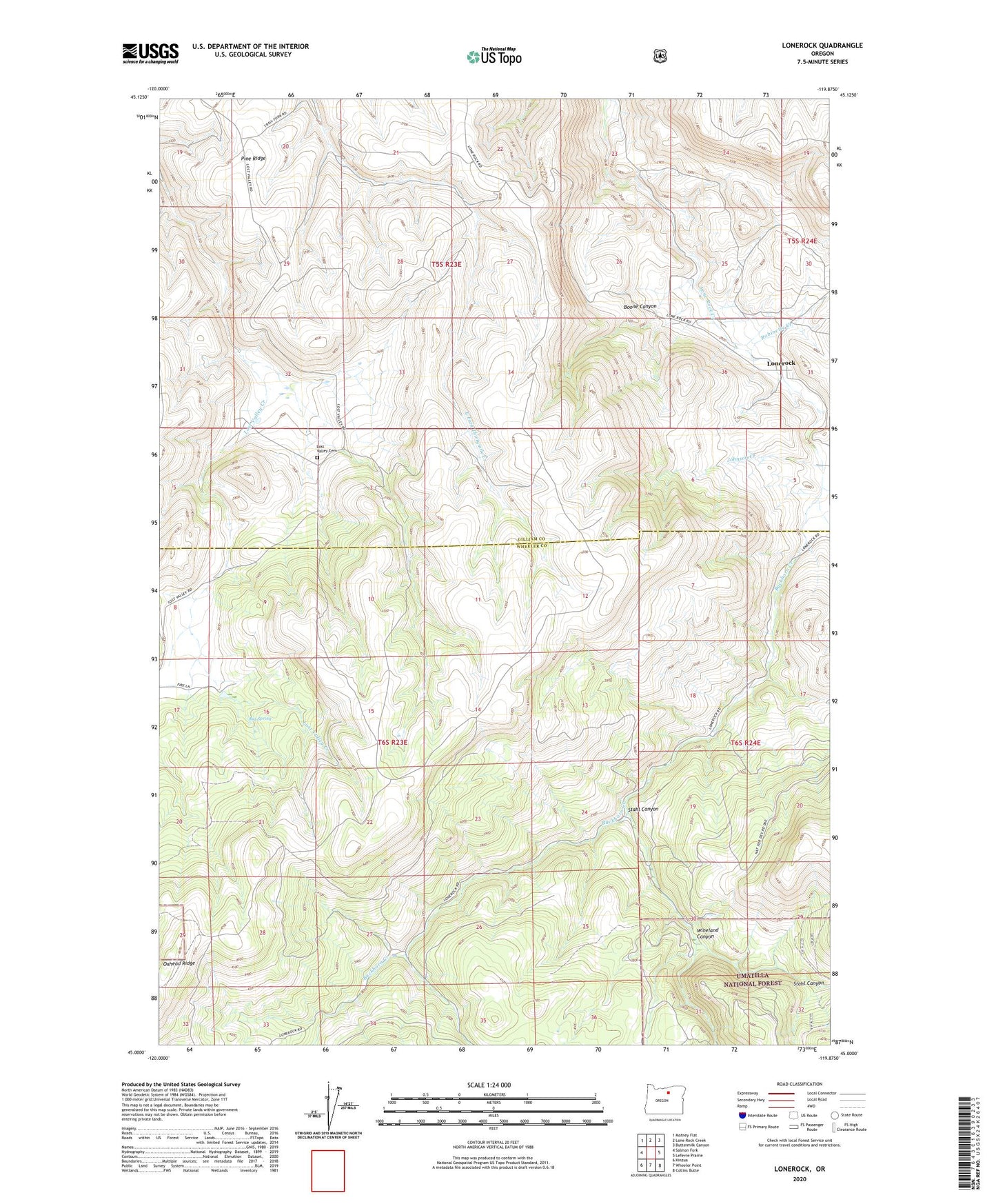
Lonerock Oregon US Topo Map
Couldn't load pickup availability
Also explore the Lonerock Forest Service Topo of this same quad for updated USFS data
2024 topographic map quadrangle Lonerock in the state of Oregon. Scale: 1:24000. Based on the newly updated USGS 7.5' US Topo map series, this map is in the following counties: Gilliam, Wheeler. The map contains contour data, water features, and other items you are used to seeing on USGS maps, but also has updated roads and other features. This is the next generation of topographic maps. Printed on high-quality waterproof paper with UV fade-resistant inks.
Quads adjacent to this one:
West: Salmon Fork
Northwest: Matney Flat
North: Lone Rock Creek
Northeast: Buttermilk Canyon
East: Lefevre Prairie
Southeast: Collins Butte
South: Wheeler Point
Southwest: Kinzua
This map covers the same area as the classic USGS quad with code o45119a8.
Contains the following named places: Big Spring, Boone Canyon, Brown Creek, Buckhorn Creek, City of Lonerock, Cone Mill, Goff Canyon, Johnson Creek, Lonerock, Lonerock Post Office, Lost Valley, Lost Valley Cemetery, Lost Valley Post Office, Pine Ridge, Robinette Creek, Stahl Canyon, Wineland Canyon