MyTopo
Lambing Canyon Oregon US Topo Map
Couldn't load pickup availability
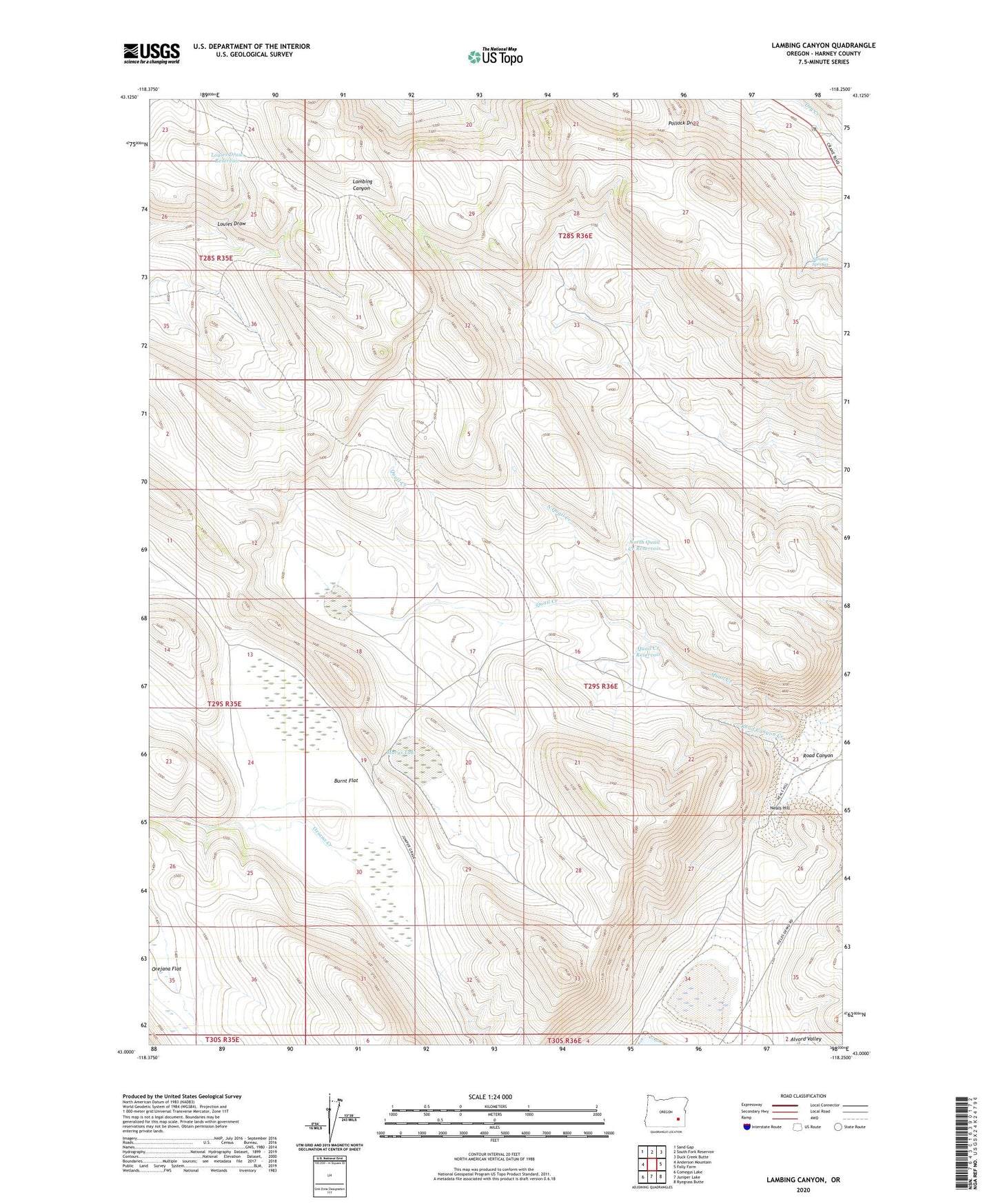
2023 topographic map quadrangle Lambing Canyon in the state of Oregon. Scale: 1:24000. Based on the newly updated USGS 7.5' US Topo map series, this map is in the following counties: Harney. The map contains contour data, water features, and other items you are used to seeing on USGS maps, but also has updated roads and other features. This is the next generation of topographic maps. Printed on high-quality waterproof paper with UV fade-resistant inks.
Quads adjacent to this one:
West: Anderson Mountain
Northwest: Sand Gap
North: South Fork Reservoir
Northeast: Duck Creek Butte
East: Folly Farm
Southeast: Ryegrass Butte
South: Juniper Lake
Southwest: Comegys Lake
This map covers the same area as the classic USGS quad with code o43118a3.
Contains the following named places: Burnt Flat, Five Cent Lake, Louies Draw, Louies Draw Reservoir, Marys Lake, Neals Hill, Neals Lake, North Quail Creek, North Quail Creek Reservoir, Orejana Flat, Oriana Creek, Quail Creek Reservoir, Road Canyon, Road Canyon Creek, Summit Springs