MyTopo
Sand Gap Oregon US Topo Map
Couldn't load pickup availability
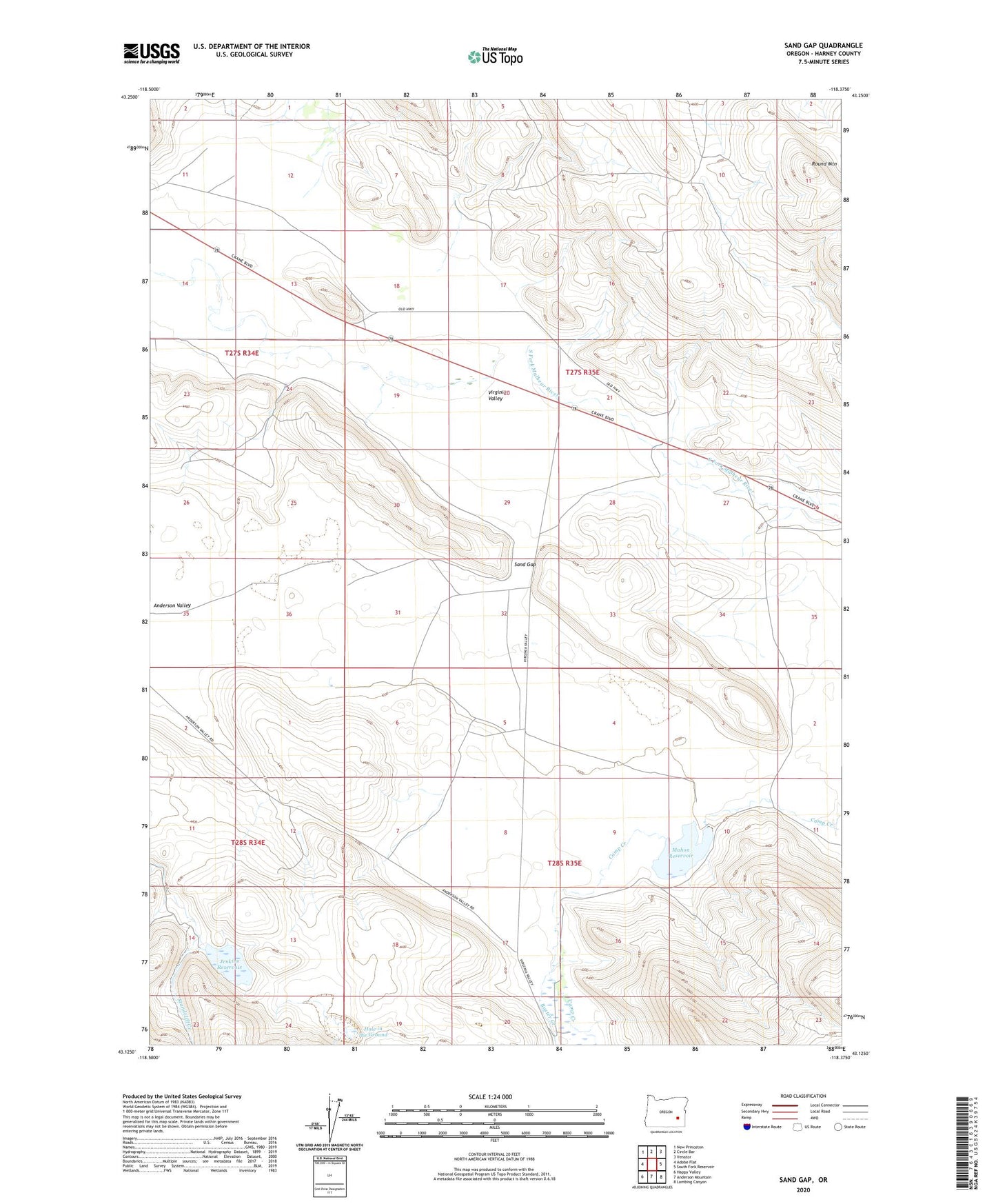
2023 topographic map quadrangle Sand Gap in the state of Oregon. Scale: 1:24000. Based on the newly updated USGS 7.5' US Topo map series, this map is in the following counties: Harney. The map contains contour data, water features, and other items you are used to seeing on USGS maps, but also has updated roads and other features. This is the next generation of topographic maps. Printed on high-quality waterproof paper with UV fade-resistant inks.
Quads adjacent to this one:
West: Adobe Flat
Northwest: New Princeton
North: Circle Bar
Northeast: Venator
East: South Fork Reservoir
Southeast: Lambing Canyon
South: Anderson Mountain
Southwest: Happy Valley
This map covers the same area as the classic USGS quad with code o43118b4.
Contains the following named places: Anderson Valley Ranch, Buster Creek, Davies Place, Hole in the Ground, Jenkins Reservoir, Mahon Dam, Mahon Reservoir, Round Mountain, Sand Gap, Saunders Place, Tom Jenkins Ranch, Virginia Valley School