MyTopo
Lane Lake Oregon US Topo Map
Couldn't load pickup availability
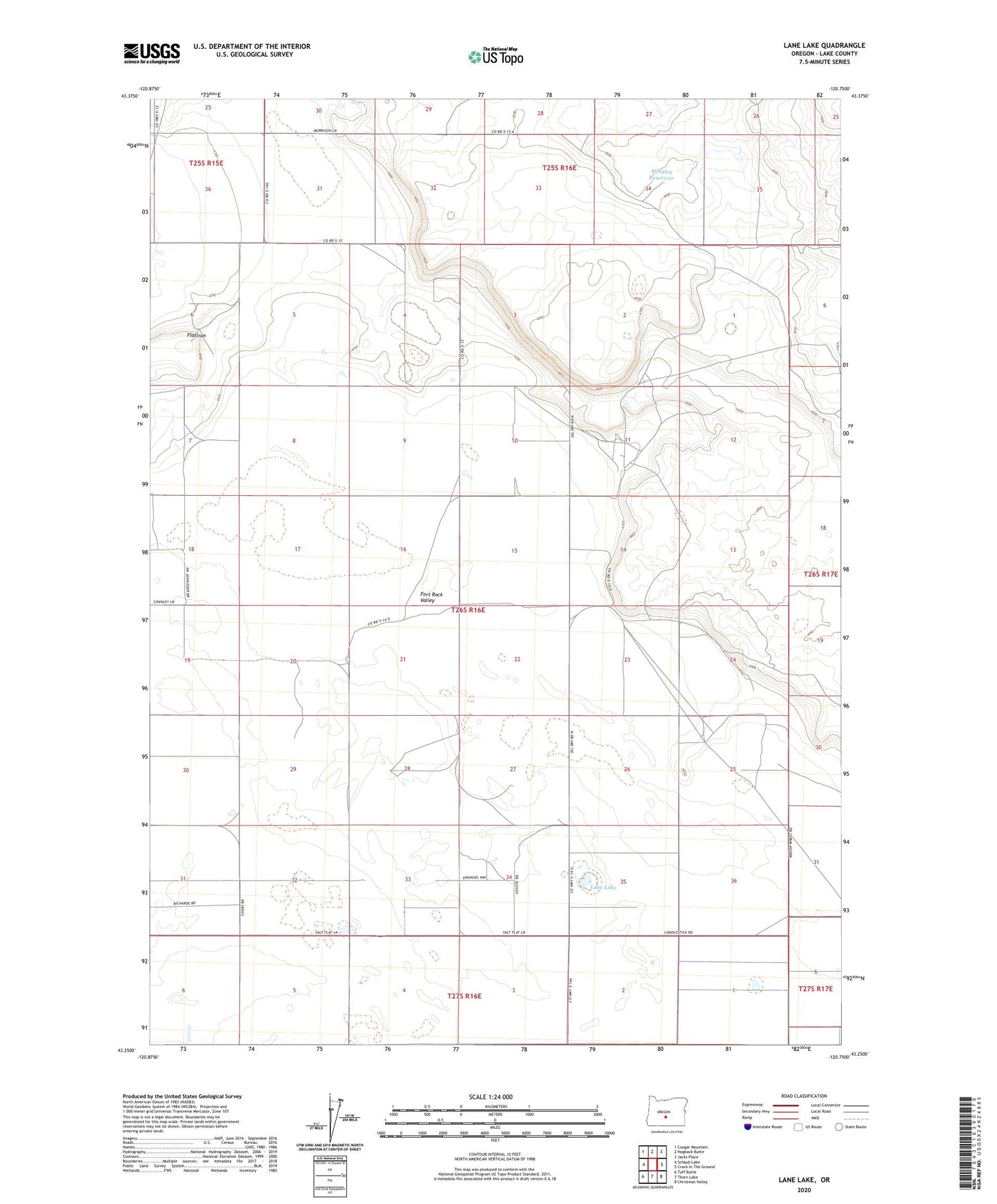
2020 topographic map quadrangle Lane Lake in the state of Oregon. Scale: 1:24000. Based on the newly updated USGS 7.5' US Topo map series, this map is in the following counties: Lake. The map contains contour data, water features, and other items you are used to seeing on USGS maps, but also has updated roads and other features. This is the next generation of topographic maps. Printed on high-quality waterproof paper with UV fade-resistant inks.
Quads adjacent to this one:
West: Schaub Lake
Northwest: Cougar Mountain
North: Hogback Butte
Northeast: Jacks Place
East: Crack In The Ground
Southeast: Christmas Valley
South: Thorn Lake
Southwest: Tuff Butte
Contains the following named places: Flatiron, Fleetwood, Fleetwood Post Office, Gerkin Well, Lane Lake, Loma Vista, Loma Vista Post Office, Morehouse Well, Mrs B A Gordon Ranch, Stingley Reservoir