MyTopo
Last Chance Lake Oregon US Topo Map
Couldn't load pickup availability
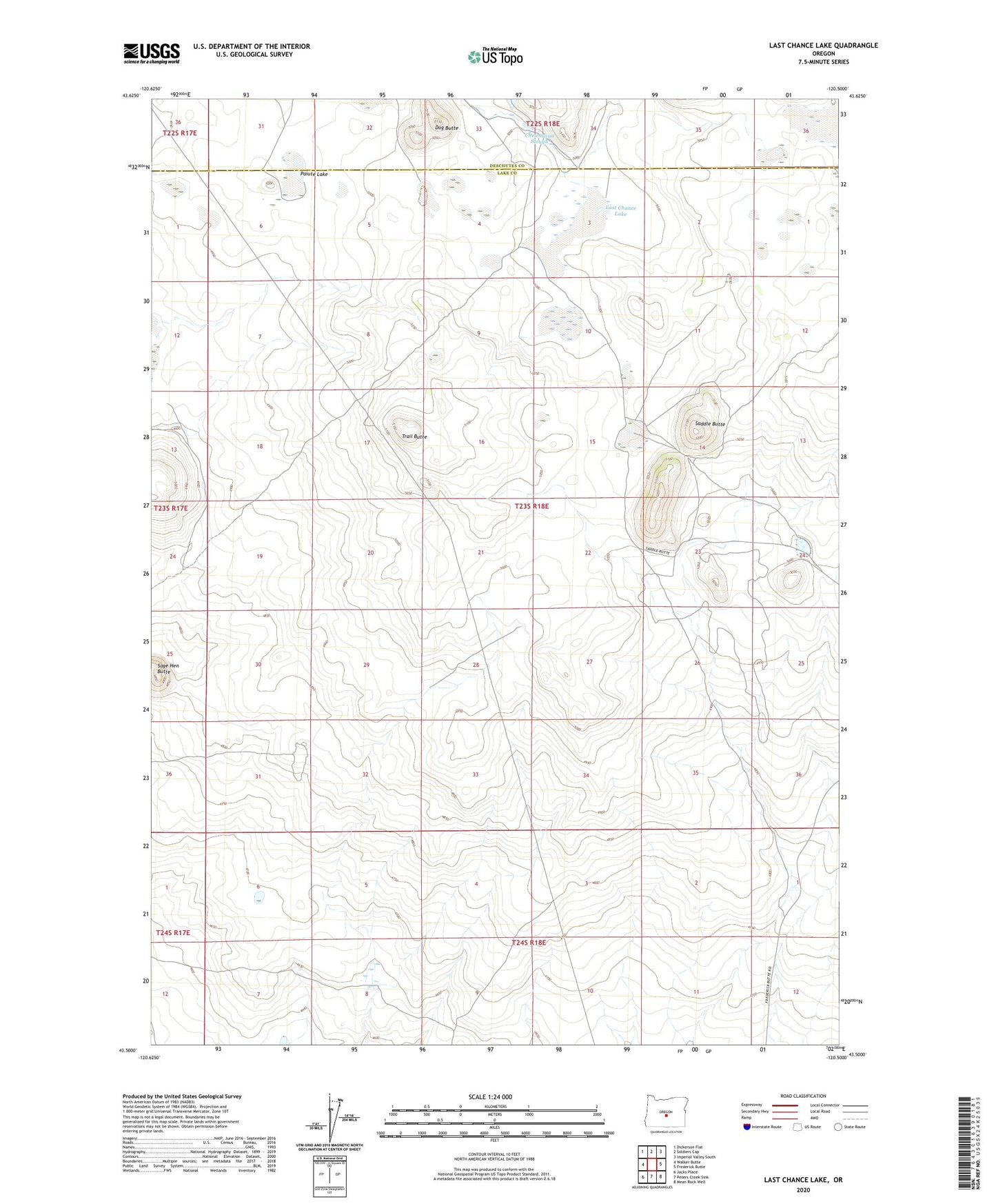
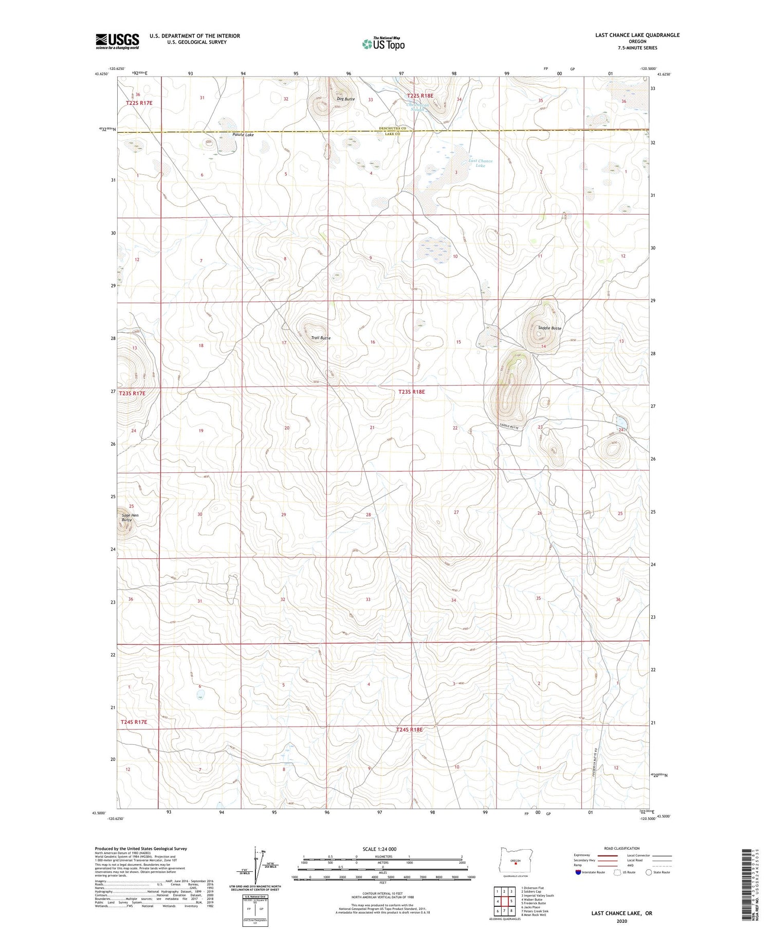
2020 topographic map quadrangle Last Chance Lake in the state of Oregon. Scale: 1:24000. Based on the newly updated USGS 7.5' US Topo map series, this map is in the following counties: Lake, Deschutes. The map contains contour data, water features, and other items you are used to seeing on USGS maps, but also has updated roads and other features. This is the next generation of topographic maps. Printed on high-quality waterproof paper with UV fade-resistant inks.
Quads adjacent to this one:
West: Walker Butte
Northwest: Dickerson Flat
North: Soldiers Cap
Northeast: Imperial Valley South
East: Frederick Butte
Southeast: Mean Rock Well
South: Peters Creek Sink
Southwest: Jacks Place
Contains the following named places: Chewaucan Slough, Dog Butte, East Walker Reservoir, Last Chance Lake, Last Chance Well, Paiute Lake, Saddle Butte, Sage Hen Butte, Trail Butte