MyTopo
Lawson Mountain Oregon US Topo Map
Couldn't load pickup availability
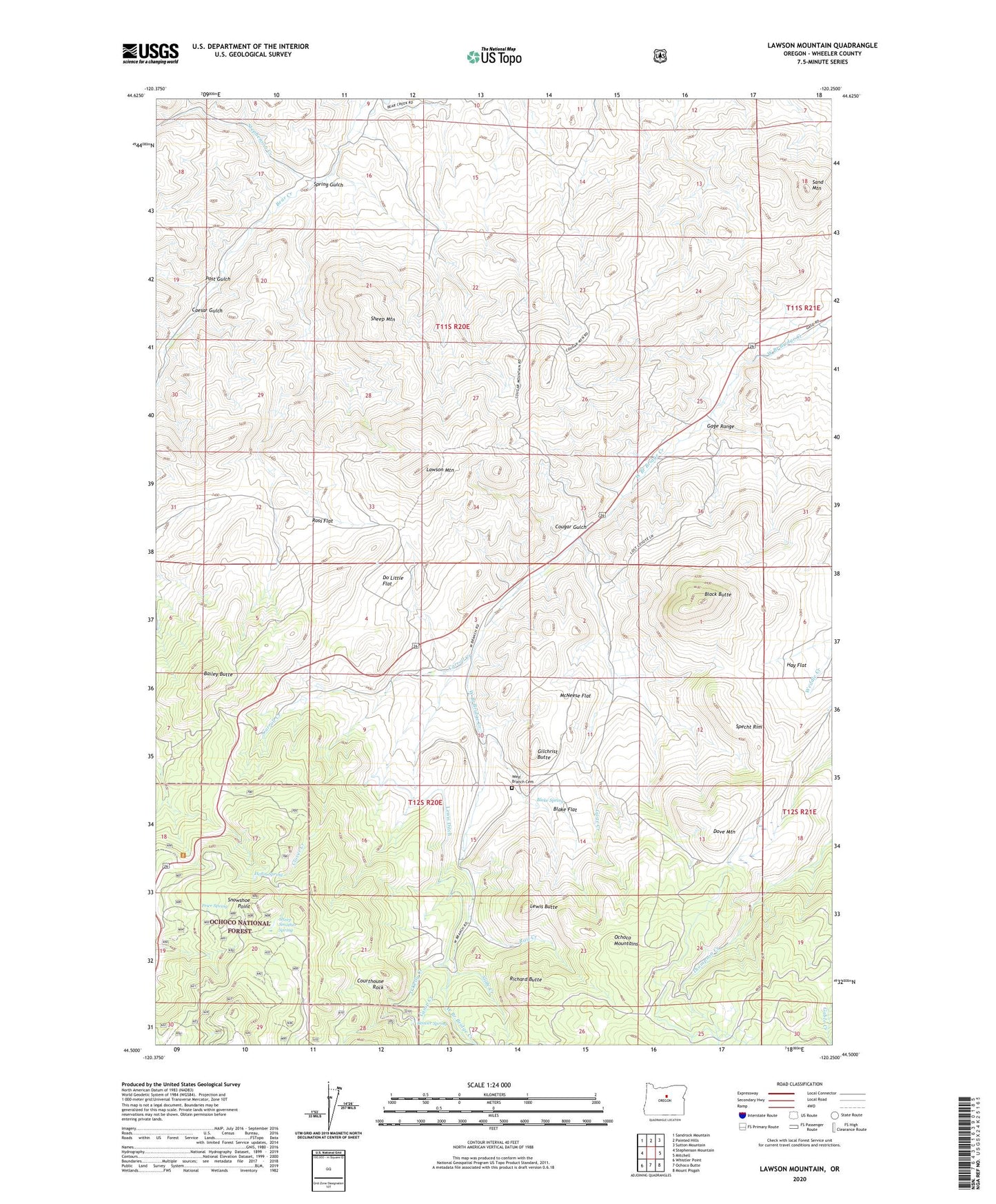
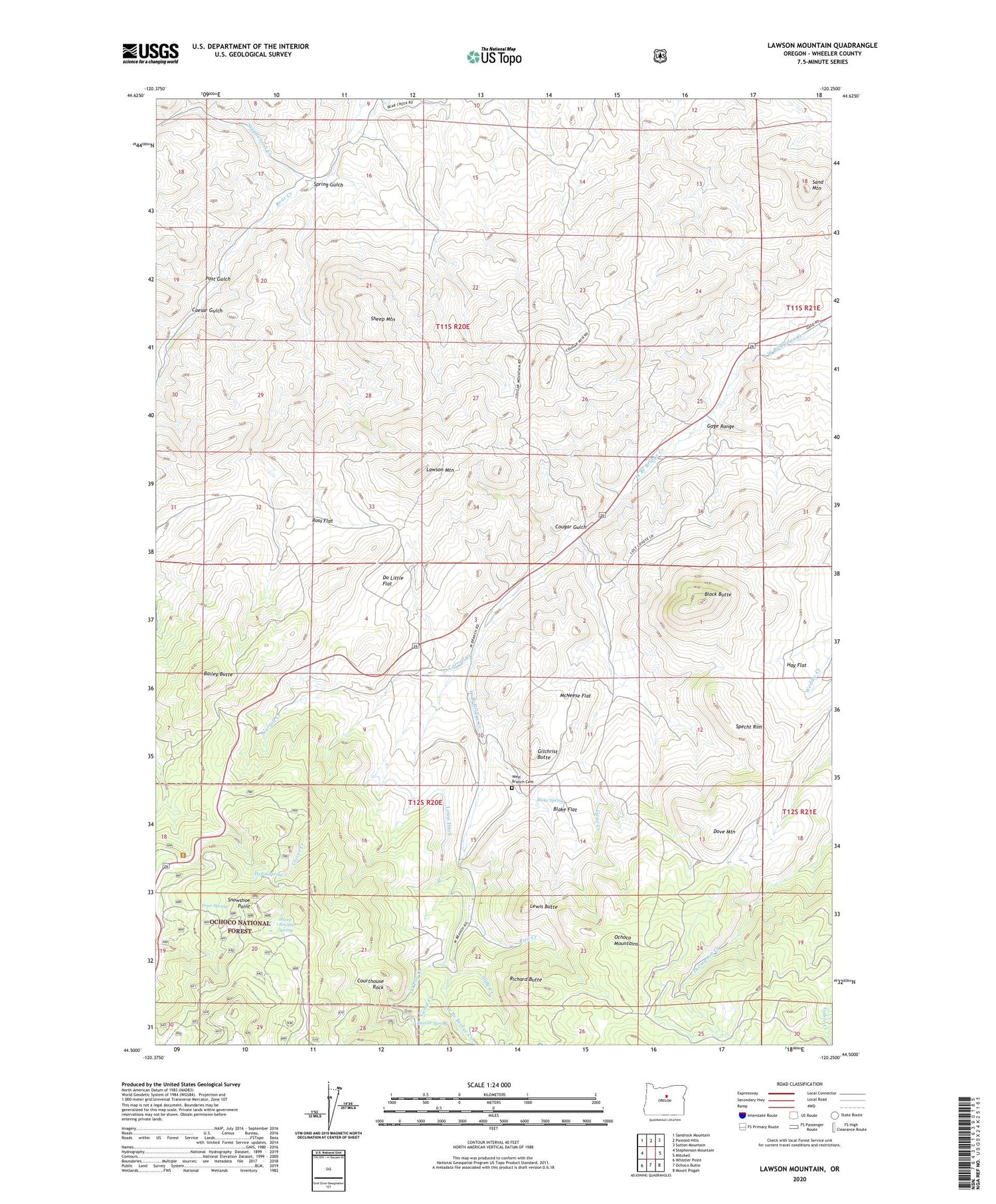
2020 topographic map quadrangle Lawson Mountain in the state of Oregon. Scale: 1:24000. Based on the newly updated USGS 7.5' US Topo map series, this map is in the following counties: Wheeler. The map contains contour data, water features, and other items you are used to seeing on USGS maps, but also has updated roads and other features. This is the next generation of topographic maps. Printed on high-quality waterproof paper with UV fade-resistant inks.
Quads adjacent to this one:
West: Stephenson Mountain
Northwest: Sandrock Mountain
North: Painted Hills
Northeast: Sutton Mountain
East: Mitchell
Southeast: Mount Pisgah
South: Ochoco Butte
Southwest: Whistler Point
Contains the following named places: Bailey Butte, Beaver Forest Service Station, Beaver Spring, Black Butte, Blake Flat, Blake Spring, Caesar Gulch, Camp Creek, Carroll Creek, Clover Creek, Cougar Gulch, Courthouse Rock, Do Little Flat, Dove Mountain, Fitzgerald Ranch, Frier Spring, Gage Creek, Gage Ranch, Gage Range, Gilchrist Butte, Hay Flat, Heflin Spring, Howard Ranch, Ihrig Ranch, Jones Ranch, Lawson Mountain, Lewis Butte, Lewis Ditch, Liberty Post Office, McNeese Flat, Mossy Rock Camp, O'Kelly Creek, Payne Ranch, Post Gulch, Rail Creek, Richard Butte, Ross Flat, Sand Mountain, Sheep Mountain, Sheep Smother Spring, Slide Creek, Snowshoe Point, Specht Rim, Spring Gulch, Stephenson Creek, West Branch Cemetery, Woodward Ranch