MyTopo
Sandrock Mountain Oregon US Topo Map
Couldn't load pickup availability
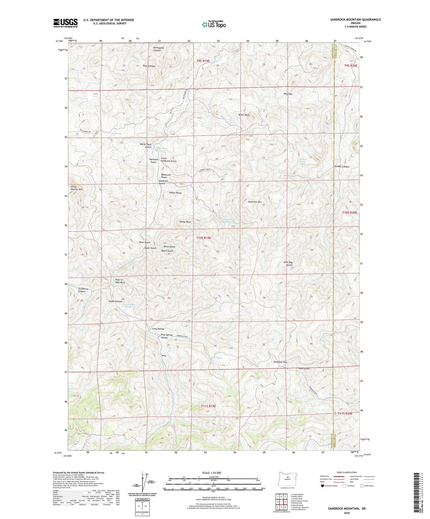
2023 topographic map quadrangle Sandrock Mountain in the state of Oregon. Scale: 1:24000. Based on the newly updated USGS 7.5' US Topo map series, this map is in the following counties: Jefferson, Wheeler. The map contains contour data, water features, and other items you are used to seeing on USGS maps, but also has updated roads and other features. This is the next generation of topographic maps. Printed on high-quality waterproof paper with UV fade-resistant inks.
Quads adjacent to this one:
West: Horse Heaven Creek
Northwest: Arrastra Butte
North: Muddy Ranch
Northeast: Jennies Peak
East: Painted Hills
Southeast: Lawson Mountain
South: Stephenson Mountain
Southwest: Opal Mountain
This map covers the same area as the classic USGS quad with code o44120f4.
Contains the following named places: Balanced Rocks, Black Rock, Blind Gulch, Broken Shovel Spring, Buck Gulch, Cherry Creek Dam, Cherry Spring, Dry Creek, Grade, Grade Post Office, Hells Half Acre, Hole in Wall Rock, Horse Creek, Horse Heaven Mountain, Indian Rocks, Kaser Ranch, Kinney Canyon, Little Sandrock Gulch, Log House Spring, Long Hollow, Oler Spring, Pine Creek, Pine Spring, Pine Spring Hollow, Quail Gulch, Red Gap, Root Gulch, Ryestack Gulch, Sandrock Gulch, Sandrock Mountain, Sandrock Springs, Sheep Hollow, Sheep Rock, Studhorse Canyon, Tompkins Pass, Upper Cherry Creek Ranch, White Rock Gulch, White Rock Spring, Wyman Creek