MyTopo
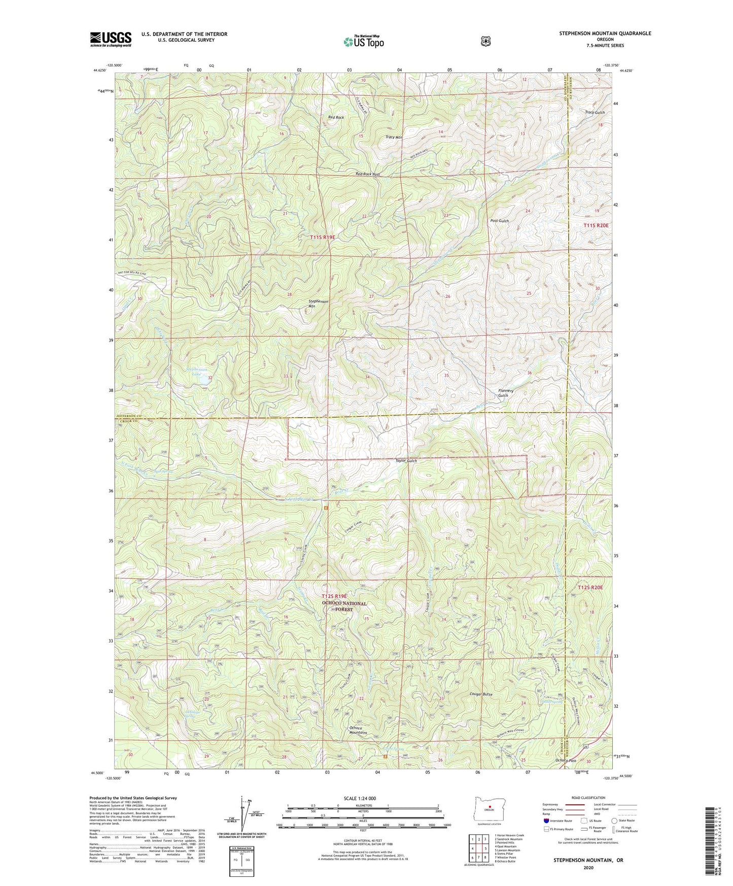
Stephenson Mountain Oregon US Topo Map
Couldn't load pickup availability
Also explore the Stephenson Mountain Forest Service Topo of this same quad for updated USFS data
2024 topographic map quadrangle Stephenson Mountain in the state of Oregon. Scale: 1:24000. Based on the newly updated USGS 7.5' US Topo map series, this map is in the following counties: Jefferson, Crook, Wheeler. The map contains contour data, water features, and other items you are used to seeing on USGS maps, but also has updated roads and other features. This is the next generation of topographic maps. Printed on high-quality waterproof paper with UV fade-resistant inks.
Quads adjacent to this one:
West: Opal Mountain
Northwest: Horse Heaven Creek
North: Sandrock Mountain
Northeast: Painted Hills
East: Lawson Mountain
Southeast: Ochoco Butte
South: Whistler Point
Southwest: Steins Pillar
This map covers the same area as the classic USGS quad with code o44120e4.
Contains the following named places: Bear Spring, Cougar Butte, Cougar Creek, Dodds Creek, Dodds Spring, Flannery Gulch, Grant Creek, Grant Spring, Heflin Creek, Jackalope Spring, Lake Fork, Lucky Strike Mine, Ludwick Cabin, North Fork Bear Creek, Ochoco Agate Beds, Ochoco Divide Recreation Site, Ochoco Pass, Old Stephenson Ranch, Rail Creek, Red Rock, Red Rock Pass, Scotty Creek, Stephenson Lake, Stephenson Mountain, Taylor Gulch, Tracy Gulch, Tracy Mountain, Valley View Mine