
MyTopo
Lebanon Oregon US Topo Map
Couldn't load pickup availability
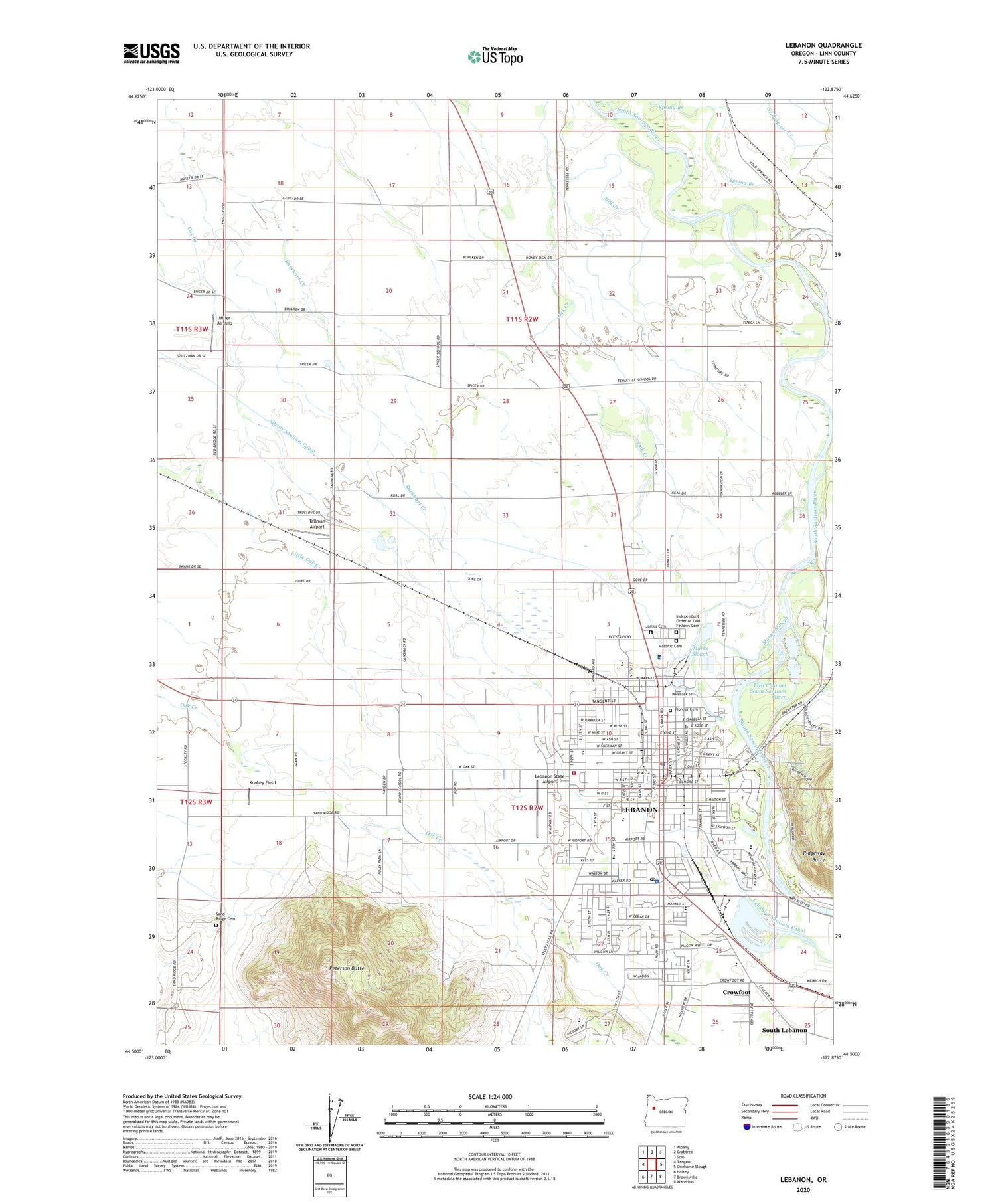
2020 topographic map quadrangle Lebanon in the state of Oregon. Scale: 1:24000. Based on the newly updated USGS 7.5' US Topo map series, this map is in the following counties: Linn. The map contains contour data, water features, and other items you are used to seeing on USGS maps, but also has updated roads and other features. This is the next generation of topographic maps. Printed on high-quality waterproof paper with UV fade-resistant inks.
Quads adjacent to this one:
West: Tangent
Northwest: Albany
North: Crabtree
Northeast: Scio
East: Onehorse Slough
Southeast: Waterloo
South: Brownsville
Southwest: Halsey
Contains the following named places: Balm, Booth Park, Calahan, Cascades School, Century Park, Cheadle Lake, Christopher Columbus Park, City of Lebanon, Cranor, Crowfoot, Denny School, Department of Motor Vehicles Lebanon, East Channel South Santiam River, East Linn Christian Academy, Evansville, Gills Landing, Gill's Landing City Boat Ramp, Good Samaritan Lebanon Community Hospital Blood Bank, Gore School, Green Acres School, Had Irvine Park, Independent Order of Odd Fellows Cemetery, Irvinville, James Cemetery, Jaycee Park, KGAL - AM, KIQY-FM, Knokey Field, Lebanon, Lebanon City Hall, Lebanon Division, Lebanon Evangelical Church, Lebanon Fire District Station 31, Lebanon Foursquare Church, Lebanon High School, Lebanon Hospital Heliport, Lebanon Lumber Company, Lebanon Maintenance Operations, Lebanon oe Connection, Lebanon oe Siding, Lebanon Police Department, Lebanon Post Office, Lebanon Public Library, Lebanon Santiam Canal, Lebanon State Airport, Lebanon Wastewater Treatment Plant, Linn County Justice Center Municipal Court, Linn County Justice Court Lebanon, Linn County Sheriff's Office Lebanon Substation, Marks Slough, Masonic Cemetery, Miller Airstrip, Newbern Post Office, Oak Creek, Oregon State University Agricultural Experiment Station, Peterson Butte, Pioneer Cemetery, Pioneer School, Queen Anne Elementary School, Ralston Park, River Park, Riverview Elementary School, Saint Edwards School, Samaritan Lebanon Community Hospital, Sand Ridge Cemetery, Sand Ridge School, Santiam School, Seven Oak Middle School, Seventh Day Adventist School, South Lebanon, South Lebanon Census Designated Place, Spicer, Spicer Post Office, Spring Branch, Tallman, Tallman Airport, Tallman Post Office, Tennessee Middle School, Volbeda Dairy, Washburn, Weldwood, Weldwood Park, Willamette Speedway and Outdoor Karts Speedway


