MyTopo
Scio Oregon US Topo Map
Couldn't load pickup availability
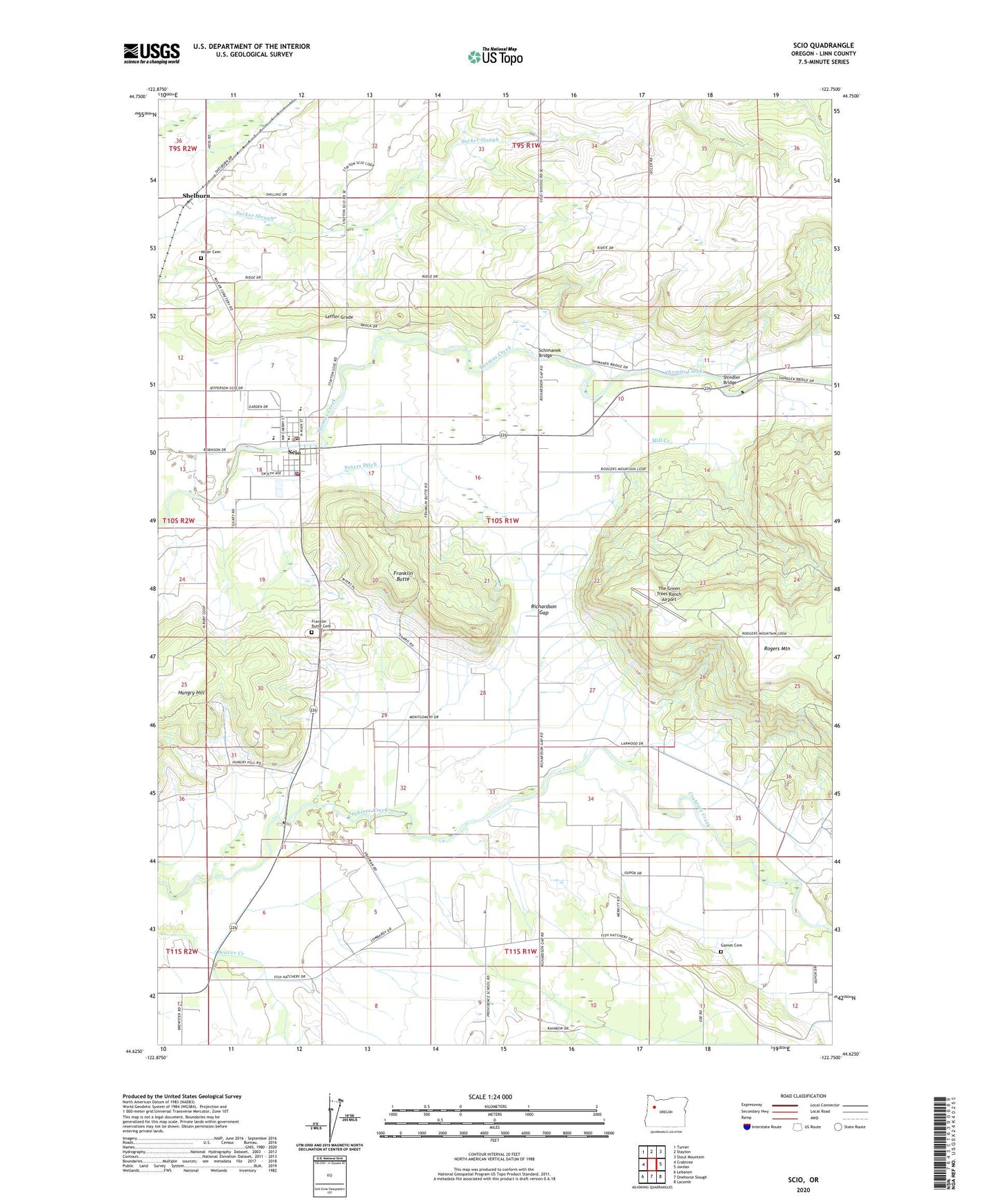
2023 topographic map quadrangle Scio in the state of Oregon. Scale: 1:24000. Based on the newly updated USGS 7.5' US Topo map series, this map is in the following counties: Linn. The map contains contour data, water features, and other items you are used to seeing on USGS maps, but also has updated roads and other features. This is the next generation of topographic maps. Printed on high-quality waterproof paper with UV fade-resistant inks.
Quads adjacent to this one:
West: Crabtree
Northwest: Turner
North: Stayton
Northeast: Stout Mountain
East: Jordan
Southeast: Lacomb
South: Onehorse Slough
Southwest: Lebanon
This map covers the same area as the classic USGS quad with code o44122f7.
Contains the following named places: Ballins Mill, Centennial Elementary School, City of Scio, Dotyville, Dotyville Post Office, Evergreen Church of God in Christ Mennonite Church, Franklin Butte, Franklin Butte Cemetery, Gourley Dairy, Jacks Heliport, Kotan Cemetery, Leffler Grade, Linn County Sheriff's Office Scio Substation, Mill Creek, Miller Cemetery, Oregon Connections Academy, Peters Ditch, Richardson Gap, Richardson Gap Grange Hall, Rosa Post Office, Schimanek Bridge, Scio, Scio City Hall, Scio High School, Scio Junction, Scio Middle School, Scio Municipal Court, Scio Post Office, Scio Public Library, Scio Public Works Department Office, Scio Rural Fire Protection District Station 90, Scio Rural Fire Protection District Station 91, Scio Sewage Treatment Facility, Scio-Lacomb Division, Shelburn, Shelburn Post Office, Shindler Bridge, The Green Trees Ranch Airport, Tolstoj Sokol Lodge, Trollinger, ZIP Code: 97374