MyTopo
Lewis Creek Oregon US Topo Map
Couldn't load pickup availability
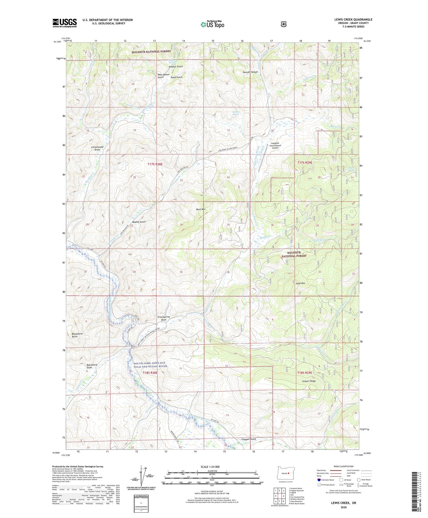
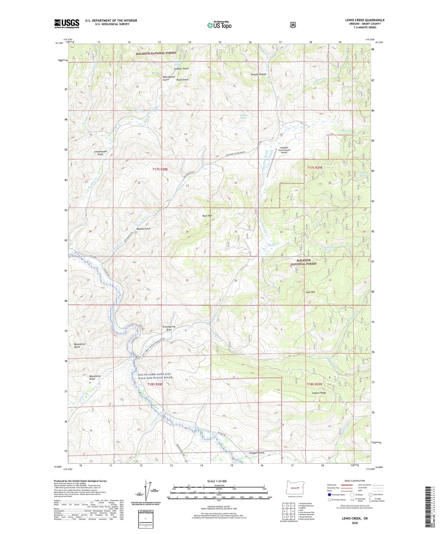
2020 topographic map quadrangle Lewis Creek in the state of Oregon. Scale: 1:24000. Based on the newly updated USGS 7.5' US Topo map series, this map is in the following counties: Grant. The map contains contour data, water features, and other items you are used to seeing on USGS maps, but also has updated roads and other features. This is the next generation of topographic maps. Printed on high-quality waterproof paper with UV fade-resistant inks.
Quads adjacent to this one:
West: Izee
Northwest: Graylock Butte
North: Flagtail Mountain
Northeast: Logdell
East: Five Hundred Flat
Southeast: West Myrtle Butte
South: Alsup Mountain
Southwest: Whiskey Mountain
Contains the following named places: Antelope Creek, Badley Gulch, Blackhorse Butte, Blackhorse Draw, Bradley Ranch, Buck Mountain, Bunton Creek, Bush Ranch, C H Jackson Ranch, Caps Creek, Chappel Gulch, Chappel Gulch Reservoir, Corral Creek, Cottonwood Draw, Duncan Hollow, Flat Creek, Grasshopper Creek, Greenspring Draw, H H Trowbridge Ranch, H Officer Ranch, Hyde Ranch, Inshallah International Airport, Johnnie Creek, Lewis Creek, Lonesome Creek, Officer Creek, Officer Ranch, Officer Spring, P W Hyde Ranch, Road Gulch, Seneca Division, Smoky Creek, Smoky Spring, Stonewall Creek, Sulphur Gulch, Sulphur Spring, Tamarack Creek, Utley Creek, Venator Creek, Walt Brown Gulch, Wickiser Slough, Wickiser Spring