MyTopo
Lionshead Oregon US Topo Map
Couldn't load pickup availability
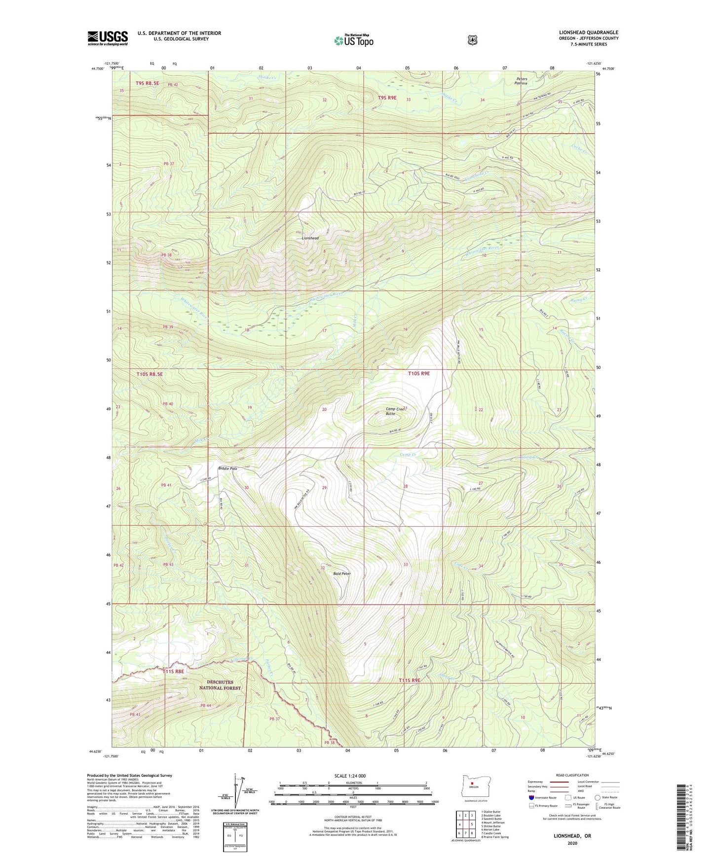
2020 topographic map quadrangle Lionshead in the state of Oregon. Scale: 1:24000. Based on the newly updated USGS 7.5' US Topo map series, this map is in the following counties: Jefferson. The map contains contour data, water features, and other items you are used to seeing on USGS maps, but also has updated roads and other features. This is the next generation of topographic maps. Printed on high-quality waterproof paper with UV fade-resistant inks.
Quads adjacent to this one:
West: Mount Jefferson
Northwest: Olallie Butte
North: Boulder Lake
Northeast: Sawmill Butte
East: Shitike Butte
Southeast: Prairie Farm Spring
South: Candle Creek
Southwest: Marion Lake
Contains the following named places: Bald Peter, Biddle Pass, Camp Creek Butte, Camp Creek Ranger Station, Camp Creek Reservoir, Lionshead, Lionshead Creek, Milk Creek, Parker Creek, Toto Creek