MyTopo
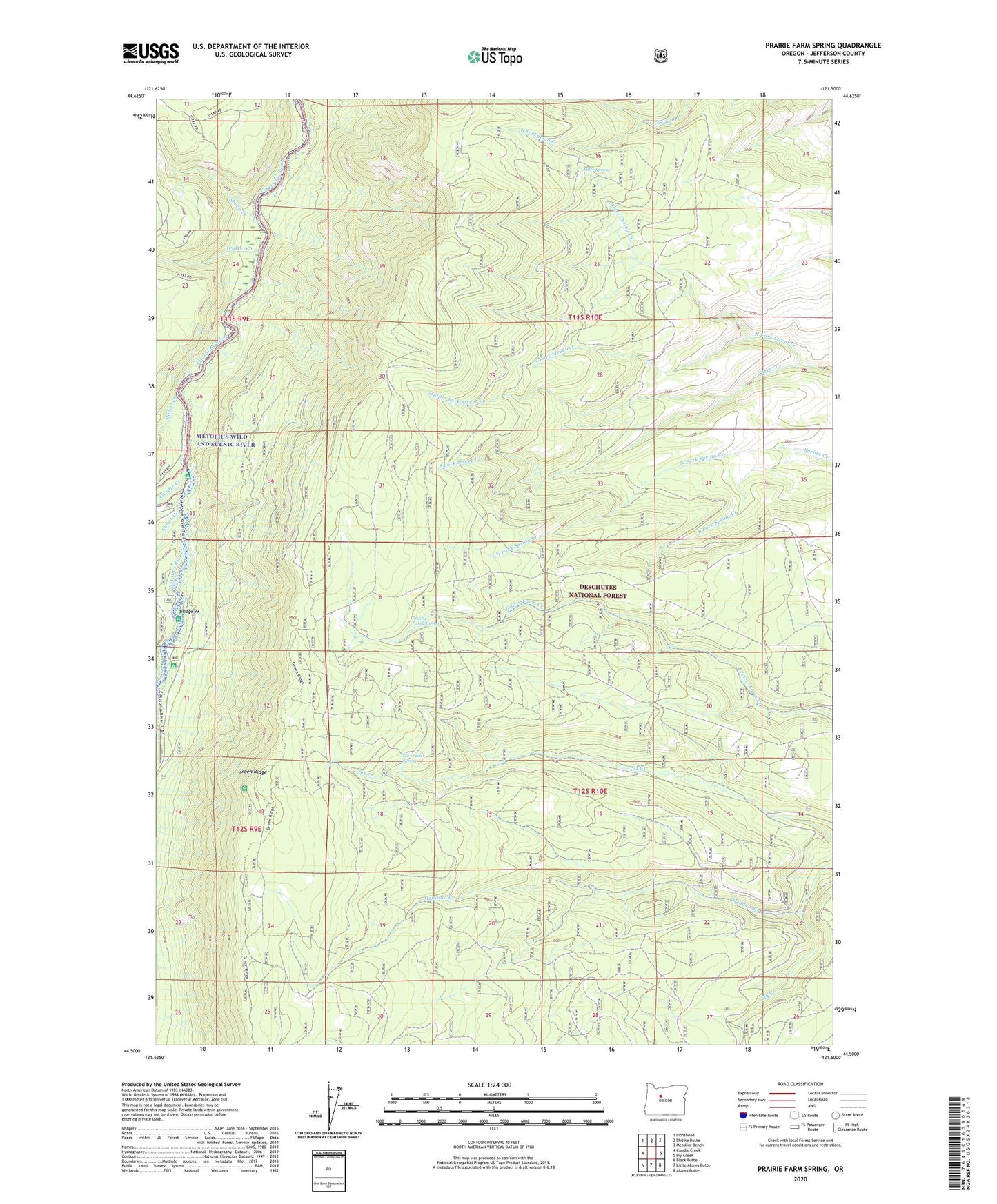
Prairie Farm Spring Oregon US Topo Map
Couldn't load pickup availability
Also explore the Prairie Farm Spring Forest Service Topo of this same quad for updated USFS data
2023 topographic map quadrangle Prairie Farm Spring in the state of Oregon. Scale: 1:24000. Based on the newly updated USGS 7.5' US Topo map series, this map is in the following counties: Jefferson. The map contains contour data, water features, and other items you are used to seeing on USGS maps, but also has updated roads and other features. This is the next generation of topographic maps. Printed on high-quality waterproof paper with UV fade-resistant inks.
Quads adjacent to this one:
West: Candle Creek
Northwest: Lionshead
North: Shitike Butte
Northeast: Metolius Bench
East: Fly Creek
Southeast: Akawa Butte
South: Little Akawa Butte
Southwest: Black Butte
This map covers the same area as the classic USGS quad with code o44121e5.
Contains the following named places: Abbot Creek, Alder Spring, Alder Spring Creek, Bridge 99, Candle Creek, Candle Creek Recreation Site, Grandview Division, Green Ridge, Green Ridge Lookout Tower, Jefferson Creek, Lower Bridge Recreation Site, Mariel Creek, Meadow Creek, Metolius Wild and Scenic River, Middle Fork Street Creek, North Fork Bean Creek, North Fork Spring Creek, North Fork Street Creek, Pioneer Ford Recreation Site, Prairie Farm Guard Station, Prairie Farm Spring, Reservation Trail, Sheep Creek, Six Creek Spring, South Fork Bean Creek, South Fork Spring Creek, South Fork Street Creek, Sugar Pine Camp, Walker Creek