MyTopo
Boulder Lake Oregon US Topo Map
Couldn't load pickup availability
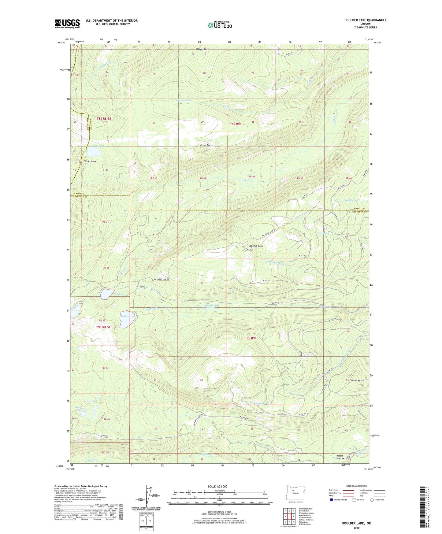
2023 topographic map quadrangle Boulder Lake in the state of Oregon. Scale: 1:24000. Based on the newly updated USGS 7.5' US Topo map series, this map is in the following counties: Jefferson, Wasco, Marion. The map contains contour data, water features, and other items you are used to seeing on USGS maps, but also has updated roads and other features. This is the next generation of topographic maps. Printed on high-quality waterproof paper with UV fade-resistant inks.
Quads adjacent to this one:
West: Olallie Butte
Northwest: Pinhead Buttes
North: Fort Butte
Northeast: Sidwalter Buttes
East: Sawmill Butte
Southeast: Shitike Butte
South: Lionshead
Southwest: Mount Jefferson
This map covers the same area as the classic USGS quad with code o44121g6.
Contains the following named places: Badger Butte, Blue Lake, Blue Lake Camas Prairie Trail, Boulder Creek Meadows, Boulder Lake, Camp One Trail, Cedar Butte, Cedar Meadow, Cinder Cone, Francis Lake, Island Lake, Lookout Butte, North Butte, Owl Spring, Peters Pasture, Trout Lake, Trout Lake Campground